What is recorded here
From OpenStreetMap (© OpenStreetMap contributors) w1467981450
Places near here
Photo credits
- Maker not stated on source page, fi.pinterest.com
- Maker not stated on source page, www.dreamstime.com
- Maker not stated on source page, commons.wikimedia.org
- Michael Murtagh, Geograph · CC BY-SA 2.0
- Kenneth Allen, Wikimedia Commons · CC BY-SA 2.0
- Maker not stated on source page, en.wikipedia.org
- Maker not stated on source page, www.pinterest.com
- Maker not stated on source page, www.flickr.com
- Kenneth Allen, Geograph · CC BY-SA 2.0
 Standing stone in BallymacilcurrStanding Stone · 1.3 mi
Explorer Tom Standing stone in Ballymacilcurr is playing a serious staring contest with that tree right next to it. The rock thinks…
 Megalithic tomb? (O.S. memoir site, unlocated) in TimaconwayMegalithic tomb? (O.S. memoir site, unlocated) · 1.4 mi
Explorer Tom Timaconway’s megalithic tomb? The question mark does a lot of heavy lifting there. I’d ask the surveyors what they saw…
 Multivallate Rath & Quaker Graveyard: Dunglady Fort in DungladyMultivallate Rath & Quaker Graveyard: Dunglady Fort · 1.5 mi
Explorer Tom Multivallate Rath & Quaker Graveyard: Dunglady Fort in Dunglady has walls thick enough to stop a nosey neighbour from…
 Grillagh WaterfallWaterfall · 1.5 mi
Explorer Tom Grillagh Waterfall is where the Vikings got completely lost looking for it because they kept following the sound of the…
 Church, graveyard & penal site in GranaghanChurch, Graveyard & Penal Site · 1.6 mi
Explorer Tom Church, Graveyard & penal site in Granaghan is a three-course meal of history that tastes like old bread and strong…
 Drumnaph ForestWood · 1.9 mi
Explorer Tom Drumnaph Wood near Maghera is a surviving scrap of the great woodland that once covered much of mid-Ulster. Its…
 St. John The Baptist rc ChurchChurch · 1.9 mi
Explorer Tom St John The Baptist RC Church ended up here by total accident, probably a GPS error from another century. It looks like…
 Mapped cemeteryCemetery · 1.9 mi
Explorer Tom A cow once tried to buy this mapped cemetery because it liked the smell of the soil better than its own pasture. The…
 Fairys CastleWood · 2.4 mi
Explorer Tom Fairys Castle would win a county fair by simply standing there looking mysterious while everyone else tries to juggle…
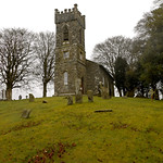 Mullagh ChurchRuins · 3.6 mi
Explorer Tom Mullagh Church in County Derry is writing 'Seeks soulmate who isn't just a pile of rubble' on its dating profile. It’s…
 Castle (unlocated) in TyaneeCastle (unlocated) · 4.0 mi
Explorer Tom Castle (unlocated) in Tyanee was once ruled by a goat who demanded cheese tolls from every traveler passing through.…
 Church & Graveyard: Kilrea Old Church or Kilrea O'diamond in KilreaChurch & Graveyard: Kilrea Old Church or Kilrea O'diamond · 5.7 mi
Explorer Tom Kilrea’s old church is also called O'Diamond, which sounds like a family dispute over a gemstone. According to Tom, it…
More castles and forts in County Derry · All of County Derry

What do you know about this place?Tap to add a comment or ask a question