What is recorded here
Ardagh Castle stood ten metres wide on an east-facing slope before ruin claimed it, leaving only an eight-metre wall and faint northern traces behind grass-covered quarries. The Lord of Slane owned the entire parish in 1640, yet no tenant name survives to explain who walked those rooms or watched the sunrise from the crest. The building vanished so completely that even its purpose remains uncertain, reducing a likely household to a shadow on old maps and a broken line of stone in the field.
Depicted as a large building (dims c. 10m x c. 10m) on the 1836 ed. of the OS 6-inch map where it is described in gothic lettering as Ardagh Castle in ruins. It is situated at the crest of an E-facing slope in an area with grass-covered quarries. The entire parish of Ardagh was owned by the Lord of Slane in 1640, including 114 acres in the Manor of Ardagh, but the name of any tenant is not recorded (Simington 1940, 369-71). One wall (L 8m; Wth 1.2m; H 1m) survives oriented NE-SW with traces of it extending further to the NE (L c. 16m).
The above description is derived from the published 'Archaeological Inventory of County Meath' (Dublin: Stationery Office, 1987). In certain instances the entries have been revised and updated in the light of recent research.
Date of revision: 3 June 2016
The monument record does not grant public access. Check the route and ask the landowner before entering private land.
- What survives
- Recorded monument
Places near here
 Cross in ArdaghCross · 220 yd
 Chruch in RuinsChurch · 226 yd
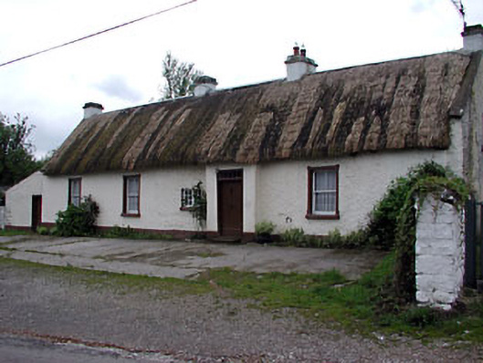 farm housefarm house · 1182 yd
 Stone CrossCross · 1520 yd
 Tree IslandWood · 1532 yd
 BarleyhillMountain / peak · 1.3 mi
 Cloghreagh Castle in RuinsCastle, unclassified · 1.8 mi
 CabraMountain / peak · 2.7 mi
 Natural Play AreaMemorial · 2.7 mi
 Dún a Rí Forest ParkForest · 2.7 mi
 In Memory of Our DadMemorial · 2.7 mi
 Lagan castleCastle, tower house · 2.8 mi