What is recorded here
On low mound in boggy ground overlooking sea. Group of nine partially embedded stones, two of which are upright (H 1.16m; 0.9m x 0.8m: H 1.15m; 0.83m x 0.36m), forming a rough circle. Three larger stones rest on these at SSW and NNE ends. One stone protrudes slightly in centre which is otherwise clear. Known locally as 'grappadgh' (O'Shea and Crowley 1972, 95).
From the National Monuments Service (Archaeological Survey of Ireland) record CO114-023
The monument record does not grant public access. Check the route and ask the landowner before entering private land.
- What survives
- Recorded monument
Places near here
Photo credits
- Julian Paren, Geograph · CC BY-SA 2.0
- This Photo was taken by Timothy A. Gonsalves . Feel free to use my photos, but please mention me as the author. I would much appreciate if you send me an email tagooty@yahoo.com or write on my talk page , for my information. Please contact me before commercial use. Please do not upload an edited image here without consulting me. I would like to make corrections only at my own source to ensure that the changes improve the image and are preserved. Otherwise you may upload an edited image with a new name. Please use one of the templates derivative or extract ., Wikimedia Commons · CC BY-SA 4.0
- National Inventory of Architectural Heritage
- John M, Geograph · CC BY-SA 2.0
- Jonathan Thacker, Wikimedia Commons · CC BY-SA 2.0
- Benson Wills, Wikimedia Commons · CC BY-SA 2.0
- Richard Webb, Geograph · CC BY-SA 2.0
- John M, Wikimedia Commons · CC BY-SA 2.0
- Colin Park, Geograph · CC BY-SA 2.0
- Colin Park, Wikimedia Commons · CC BY-SA 2.0
 Ballydonegan StrandBeach / strand · 849 ydBlack RocksIslet · 864 yd
 Allihies Copper Mine MuseumMuseum · 1073 yd
 Allihies Language SchoolSchool · 1111 yd
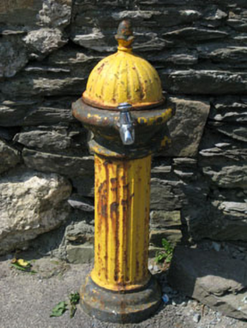 water pump1115 yd
 DooneenViewpoint · 1207 yd
 KnocknagallaunMountain / peak · 1.5 mi
 Wedge tomb in Killough EastWedge tomb · 1.8 mi
 Eagle HillMountain / peak · 2.0 mi
 Promontory fortPromontory fort, coastal · 3.1 mi
 Little IslandIslet · 3.5 mi
 White StrandBeach / strand · 3.6 mi
More archaeology and monuments in County Cork · All of County Cork
What do you know about this place?