
What is recorded here
Located towards the E end of an E-W drumlin ridge. A rectangular enclosure (ext. dims c. 50m ENE-WSW; c. 40m NW-SE) is outlined lightly with double lines on the 1834 edition of the OS 6-inch map where it is described in gothic lettering as an ‘Ancient Burial Ground’. This is depicted as within a large oval enclosure (dims c. 140m NW-SE; c. 110-125m NE-SW). The central feature has been removed without trace, but the outer enclosure is defined generally by a hedge at the top edge of a scarp (at NW: Wth 1.6m; H 2m) W-NE where there is a field bank at the base of the scarp.
The above description is derived from the published 'Archaeological Inventory of County Monaghan' (Dublin: Stationery Office, 1986). In certain instances the entries have been revised and updated in the light of recent research.
Revised by: Michael Moore
Date of revision: 19 June 2018
This remains an important historical record, but the official description says the monument is no longer visible or has been destroyed. The monument record does not grant public access. Check the route and ask the landowner before entering private land.
- What survives
- No visible remains or recorded as destroyed
Places near here
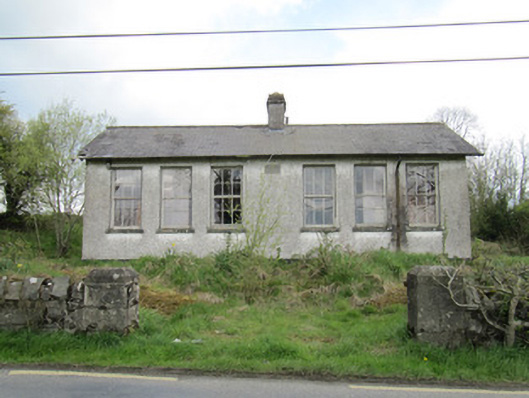 Saint Brigid's National Schoolschool · 413 yd
 school master's houseschool master's house · 467 yd
 Crannog in Cordevlis (cremorne By., Aghamullen Par.)Crannog · 629 yd
 Habitation site in Mullanary GlebeHabitation site · 660 yd
 Ballybay Wetland CentreNature reserve · 2.1 mi
 The Rabbit BurrowWood · 2.7 mi
 LisnaspeenanMountain / peak · 2.8 mi
 Fedd HillMountain / peak · 2.9 mi
 Senator Billy Fox 1939 - 1974Memorial · 5.3 mi
 CastleCastle, unclassified · 5.9 mi
 Gull IslandIslet · 7.9 mi
 Bush IslandIslet · 8.1 mi
Other information
Photo: Credit not shown in the picture search · Rights wording not checked; contact us if this picture should be removed