What is recorded here
From OpenStreetMap (© OpenStreetMap contributors) w303412225
Places near here
Picture notes
- David Dixon, Wikimedia Commons · CC BY-SA 2.0
- National Inventory of Architectural Heritage
- MikaLaureque, Wikimedia Commons · CC BY-SA 4.0
- MarieDub, Wikimedia Commons · CC BY-SA 4.0
- Ben Brooksbank, Geograph · CC BY-SA 2.0
- Kenneth Allen, Geograph · CC BY-SA 2.0
- Andreas F. Borchert, Wikimedia Commons · CC BY-SA 4.0
- Ardfern, Wikimedia Commons · CC BY-SA 3.0
- Einaz80, Wikimedia Commons · CC BY-SA 4.0
- John M, Geograph · CC BY-SA 2.0
- Computer-made picture. It does not show this playground.
 Rathlin O'Birne LighthouseLighthouse · 90 yd
Explorer Tom Rathlin O'Birne Lighthouse lit up on nuclear power in 1974. When that source faded in 1987, wind generators took over, and solar power followed. I had to read that twice: a nuclear chapter for a little lighthouse off Donegal.
 Teach Solais an Reachlainn Uí BhirnLighthouse · 91 yd
Explorer Tom Teach Solais an Reachlainn Uí Bhirn actually ran on nuclear power before solar panels! I bet the keepers were too busy checking their watches for radioactive ticks to notice the waves crashing right outside. It’s like a tiny glowing bomb living in a stone tower.
 Rathlin O'Birne IslandIslet · 433 yd
Explorer Tom Rathlin O'Birne Island's lighthouse took its time: shipowners asked for it in 1841, and the light first flashed in 1856. I would have worn out several candles waiting. Irish Lights tells the story of a working sea light here, not a public island trip.
 Malin Beg Signal TowerSignal tower · 1.7 mi
Explorer Tom Malin Beg Signal Tower is still standing tall, complete with intact bartizans and a doorway protected by corbels. It used to shout warnings about French ships, but now it just sits there, potentially filling up with rainwater. Very dramatic, very wet.
 Malin Beg HostelHostel · 2.0 mi
Explorer Tom Malin Beg Hostel sounds like a place where backpackers trade stories that sound more like horror films. Ask about the strangest guest they’ve ever had.
 Silver Strand ViewpointViewpoint · 2.2 mi
Explorer Tom Silver Strand Viewpoint looks south-west, capturing the shimmering waters and rugged coastline in a truly scenic Donegal landscape.
 Malin More Portal TombsPortal tomb · 3.0 mi
Explorer Tom Malin More Portal Tombs is a row of six chambers lined up like they’re waiting for something, all facing different directions. You’ve got one facing ENE, another SSE, and a few pointing straight at the sky or the road. It’s proper chaotic, but that 3.2m long chamber with its massive roofstone still on top is a real heavyweight.
 Rossan PointHeadland · 3.2 mi
Explorer Tom Rossan Point provides a vantage point near Malin Beg, perfect for watching the waves crash and the seagulls dance.
 Glencolmcille Folk VillageMuseum · 4.8 mi
Explorer Tom Glencolmcille Folk Village lines up Donegal homes from the 18th, 19th and 20th centuries in replica cottages. I could walk from one period to another before my tea went cold, though the furniture would change on me at every door. It is a clever way to compare ordinary lives.
 Biddy's PubPub · 5.3 mi
Explorer Tom Biddy's Pub in County Donegal is where the music stops and the shouting starts. Order a pint, look confused, and pretend you know the local dialect perfectly.
 Children's playground5.3 miComputer-made picture. It does not show this playground.
Explorer Tom Children's playground in County Donegal is likely a magnet for toddlers with bad attitudes. Check if the swings are still attached to the earth. If not, report back immediately so I can laugh at you.
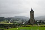 Glencolmcille Old GraveyardGraveyard · 5.5 mi
Explorer Tom Glencolmcille Old Graveyard holds two church stories: the modern church stands just north of an older church site, whose building was pulled down in 1828. I spotted a useful caution in the record too: earlier writers mentioned a circular enclosure, but the later survey saw no trace. One dot, several layers, and not all equally certain.
More islands in County Donegal · All of County Donegal

What do you know about this place?Tap to add a comment or ask a question