
What is recorded here
From OpenStreetMap (© OpenStreetMap contributors) n332373274
Places near here
Photo credits
- Colin Park, Geograph · CC BY-SA 2.0
- National Inventory of Architectural Heritage
- Maker not stated on source page, www.pinterest.com
- John Martin, Geograph · CC BY-SA 2.0
- Colin Park, Geograph · Creative Commons Attribution-ShareAlike 2.0
- Kenneth Allen, Geograph · CC BY-SA 2.0
- Maker not stated on source page, www.standard.co.uk
- Maker not stated on source page, www.bbeyondmagazine.com
- Patrice78500, Wikimedia Commons · Public domain
- Maker not stated on source page, www.gloucestershirelive.co.uk
- Ciaran Mac Murchaidh / Geograph Britain and Ireland, Wikimedia Commons
 CrockfaddaMountain / peak · 1.6 mi
Explorer Tom Crockfadda has an undefined summit. I love that the highest point on the mountain doesn't actually exist, so you can…
 Crockfadda North-East TopMountain / peak · 1.7 mi
Explorer Tom Crockfadda North-East Top is getting picked on by the wind because it insists on wearing a tiny stone cairn like a hat.…
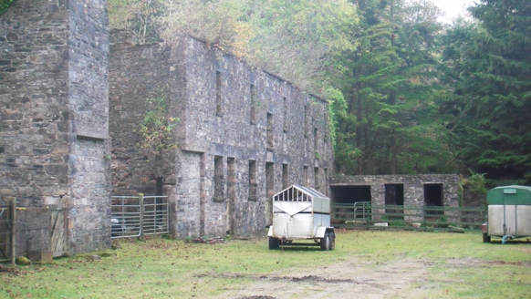 Dunlewy HouseOutbuilding · 3.0 mi
Explorer Tom Dunlewy House in Dunlewy Far is an outbuilding that thinks it’s the main event because it has such fancy stone work.…
 Anomalous stone group in Brockagh (crovehy Ed)Anomalous stone group · 3.2 mi
Explorer Tom This anomalous stone group in Brockagh sits on a slope overlooking Lough Croangar, using nine stones to form a D-shape…
 Errigal Youth HostelHostel · 3.4 mi
Explorer Tom Errigal Youth Hostel in County Donegal is where dreams go to get squished under mattresses. It's cozy if you define…
 Catholic Church of the Sacred HeartChurch/chapel · 3.4 mi
Explorer Tom Catholic Church of the Sacred Heart stands between Errigal Mountain and Lough Nacung, with a round tower and a…
 McGeady's BarPub · 3.5 mi
Explorer Tom McGeady’s Bar is sitting there looking suspiciously quiet in County Donegal, waiting for someone to ask if they’ve had…
 Island GlassIslet · 4.2 mi
Explorer Tom Island Glass is holding back its biggest secret because it knows that after three pints, it would tell you everything…
 Oileán TreorachIslet · 4.3 mi
Explorer Tom Oileán Treorach in Donegal is the kind of place Saint Patrick would have pointed at and said 'Yeah, that one’s doing…
 Páirc Naisiúnta Ghleann Bheatha - Glenveagh National ParkNature reserve · 4.4 mi
Explorer Tom Glenveagh National Park is Donegal giving you room to breathe on a grand scale: lough, bog, woodland and mountain all…
 Loch an Iúir Soldiers' Burial GroundBurial ground · 4.6 mi
Explorer Tom Loch an Iúir Soldiers' Burial Ground is officially just a peat slope overlooking the water, with zero visible remains.…
 Siúlóid an Chlocháin BhigOfficial walking route · 5.0 mi
Explorer Tom Siúlóid an Chlocháin Bhig has a name that may test your tongue and a route that rewards your feet. This Crolly loop…
More mountains and hills in County Donegal · All of County Donegal

What do you know about this place?Tap to add a comment or ask a question