What is recorded here
From the National Monuments Service (Archaeological Survey of Ireland) record MA096-013003
Places near here
Photo credits
- Keith Salvesen, Geograph · Creative Commons Attribution-ShareAlike 2.0
- Maker not stated on source page, www.tripadvisor.com
- Maker not stated on source page, www.alamy.com
- Mick Garratt, Wikimedia Commons · CC BY-SA 2.0
- Egbert Polski, Wikimedia Commons · CC BY-SA 4.0
- National Inventory of Architectural Heritage
- Eric Jones, Geograph · CC BY-SA 2.0
- Oliver Dixon, Geograph · CC BY-SA 2.0
- Graham Horn, Geograph · CC BY-SA 2.0
- Maker not stated on source page, commons.wikimedia.org
 Graveyard2.0 mi
Explorer Tom Graveyard in Kilgeever hates the bumpy road leading to it. The ground keeps settling, so the headstones are always…
 Kilgeever Church (in ruins)Church · 2.0 mi
Explorer Tom Kilgeever Church is where a fiddler played all night until his fingers bled, and he’s still in there somewhere…
 Kilgeever New CemeteryCemetery · 2.1 mi
Explorer Tom Kilgeever New Cemetery in County Mayo was nearly sold for a horse once because the paperwork had a smudge that looked…
 Ben GoramMountain / peak · 2.2 mi
Explorer Tom Ben Goram is in a feud with the next village over something daft, like who gets to blame the bad weather first. The…
 Bellakip BridgeBridge · 2.2 mi
Explorer Tom Bellakip Bridge in Bellakip is built with fieldstone and limestone dressings that are so good they could win a prize…
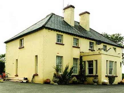 Convent of MercyConvent/nunnery · 3.2 mi
Explorer Tom Convent of Mercy in Leckanvy is watching a poet fall into a ditch nearby with mild interest. It’s all about that…
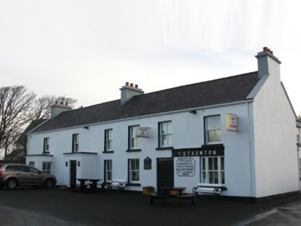 T. StauntonFarm house · 3.3 mi
Explorer Tom T. Staunton farm house in Thornhill is a reconstruction of an old structure that has retained its core identity. It…
 Croagh Patrick Pilgrim TrailWalking route · 4.3 mi
Explorer Tom Croagh Patrick Pilgrim Trail got the Vikings lost because they kept looking for a port that wasn’t there and ended up…
 Srahwee or Altoir Megalithic Wedge Tomb, Sraith Bhui (The Yellow River Land) – Clew Bay Archaeological Trail, Site 13Ruins · 4.5 mi
Explorer Tom Srahwee or Altoir Megalithic Wedge Tomb claims to be from the Bronze Age but I think it’s actually from the Jurassic…
 Crott MountainMountain / peak · 4.7 mi
Explorer Tom Crott Mountain refuses to fall down because it thinks it has a very strong sense of duty that keeps it glued to the…
 Murrisk Pier LoopWalking route · 5.0 mi
Explorer Tom Murrisk Pier Loop would handle a reality show by hiding the pier from everyone. It’s got that ‘I’m too cool for…
Murrisk PierVisitor information · 5.1 miExplorer Tom Murrisk Pier is sticking its nose into everyone's business from the water, acting like it knows where every boat has…
More archaeology and monuments in County Mayo · All of County Mayo

What do you know about this place?Tap to add a comment or ask a question