
What is recorded here
Recorded construction date: 1900 - 1919. Current recorded use: House.
From the Northern Ireland Historic Buildings Record record HB11/20/019
The official record and map point do not grant access. Many historic buildings are privately owned; view them only from public ground unless the owner allows entry.
Places near here
Photo credits
- Kenneth Allen, Geograph · CC BY-SA 2.0
- Kenneth Allen, Wikimedia Commons · CC BY-SA 2.0
- Kenneth Allen, Geograph · Creative Commons Attribution-ShareAlike 2.0
- Rossographer, Wikimedia Commons · CC BY-SA 2.0
- R0025693, Wikimedia Commons · CC BY-SA 4.0
SlievemoreMountain / peak · 1.5 mi Standing stone in CloghfinStanding Stone · 2.0 miPortal tomb: cloghfin chambered grave in AltcloghfinPortal Tomb: Cloghfin Chambered Grave · 2.2 miSixmilecross Presbyterian ChurchChurch · 3.1 miGraveyard in GlenchuilGraveyard · 3.4 miBallygawley Presbyterian ChurchChurch · 4.3 miFranciscan Friary, Round Tower, Church, Graveyard & 2 Fonts: Ballynasaggart in BallynasaggartFranciscan Friary, Round Tower, Church, Graveyard & 2 Fonts: Ballynasaggart · 4.3 miKnockmanyArchaeological place · 5.9 miCarleton's CottageHeritage attraction · 7.9 miMedieval Parish Church; Graveyard also Site of C13th Battle: Carnteel Church in CarnteelMedieval Parish Church · 8.4 miParkanaur Manor HouseCastle · 9.0 miC17th house & bawn, possibly on site of earlier fort: castle caulfield in Lisnamonaghan, CastlecaufieldC17th house & bawn, possibly on site of earlier fort: castle caulfield · 9.8 mi
 Standing stone in CloghfinStanding Stone · 2.0 mi
 Portal tomb: cloghfin chambered grave in AltcloghfinPortal Tomb: Cloghfin Chambered Grave · 2.2 mi
 Sixmilecross Presbyterian ChurchChurch · 3.1 mi
 Graveyard in GlenchuilGraveyard · 3.4 mi
 Ballygawley Presbyterian ChurchChurch · 4.3 mi
 Franciscan Friary, Round Tower, Church, Graveyard & 2 Fonts: Ballynasaggart in BallynasaggartFranciscan Friary, Round Tower, Church, Graveyard & 2 Fonts: Ballynasaggart · 4.3 mi
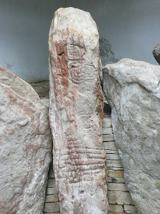 KnockmanyArchaeological place · 5.9 mi
 Carleton's CottageHeritage attraction · 7.9 mi
 Medieval Parish Church; Graveyard also Site of C13th Battle: Carnteel Church in CarnteelMedieval Parish Church · 8.4 mi
 Parkanaur Manor HouseCastle · 9.0 mi
 C17th house & bawn, possibly on site of earlier fort: castle caulfield in Lisnamonaghan, CastlecaufieldC17th house & bawn, possibly on site of earlier fort: castle caulfield · 9.8 mi
More historic places in County Tyrone · All of County Tyrone
What do you know about this place?