
Places near here
Photo credits
- Eric Jones, Geograph · CC BY-SA 2.0
- Sarahj2107, Wikimedia Commons · CC BY-SA 3.0
- Eric Jones, Wikimedia Commons · CC BY-SA 2.0
 Natural Feature: Pierce's Castle in LeitrimNatural Feature: Pierce's Castle · 767 yd
Explorer Tom Pierce's Castle in Leitrim is a natural feature that decided to be fancy without building anything itself. The builder was probably thinking about lunch. Pick a stone, any stone, and invent its biography as a former rock star who gave up fame.
 Leitrim Lodge Picnic AreaPicnic place · 1282 yd
Explorer Tom Leitrim Lodge Picnic Area is hosting a bird that refuses to leave, even when you throw crumbs at it or wave your arms around like a maniac trying to shoo it away. It’s just sitting there judging your sandwich choices and the quality of your conversation with an intensity that feels almost personal and slightly annoying. Look serious, nod slowly, you're basically an expert now.
 Rocky MountainMountain / peak · 1551 yd
Explorer Tom Rocky Mountain in County Down has had so many former names that it keeps forgetting which one is the real one today. It’s like it has a whole identity crisis going on, switching between being serious and being silly depending on which way the wind blows at the moment. Get there early and have it all to yourself.
 Crotlieve MountainMountain / peak · 1.3 mi
Explorer Tom Crotlieve Mountain in County Down nearly got famous when a tourist mistook it for a UFO landing pad and started livestreaming to millions of confused viewers. It didn’t even blink, just kept its forested head down while the cameras zoomed in and out, acting like a cool, unbothered celebrity. Make a wish, it's had centuries of practice.
 Cock, Hen, PigeonWalking route · 1.4 mi
Explorer Tom Cock, Hen, Pigeon is getting bullied by the wind because its name sounds like a chicken farm argument. The old turf pits are just silent witnesses to the chaos. Make up your own legend and I'll swear it's true.
 Yellow Water picnic sitePicnic place · 1.9 mi
Explorer Tom Yellow Water picnic site sits right off the Ulster Way, so expect hikers complaining about their blisters while eating sandwiches. It listens to the river all day, but mostly it just hears people arguing about whose turn it is to wash up. Bring a pen pal, they'll be jealous.
 West TorCliff · 2.1 mi
Explorer Tom Two families are feuding over who owns the view from West Tor in County Down, and they’ve been arguing about it so long that the rocks have started taking sides. Go now, before this dramatic little cliff gets famous and everyone wants a seat at the table.
 Summit TorCliff · 2.1 mi
Explorer Tom Summit Tor in County Down was clearly designed by a mother-in-law who wanted everyone to stand very still and appreciate the silence. It's got that kind of energy where you don't want to sneeze too loudly. Bring curiosity, leave with a better story than mine.
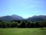 Mourne MountainsMountain range · 2.8 mi
Explorer Tom The Mourne Mountains are probably complaining to the council about how many people park on their slopes and leave their rubbish everywhere without even saying thank you. They are having a proper tantrum right now. Best visited with a curious kid and no timetable.
 Hilltown LodgeHouse · 2.9 mi
Explorer Tom Hilltown Lodge in Carcullion has a retirement plan that involves doing absolutely nothing but looking distinguished from the garden. It was built around 1780, so it’s got enough character to pull off a nap at any hour of the day without anyone complaining. Ideal for a moody photo you'll pretend wasn't posed.
 Eight Mile BridgeBridge · 2.9 mi
Explorer Tom Eight Mile Bridge in Carcullion is doing its best impression of a bridge that never got promoted. Eight miles? Please. It’s probably just eight strides if you’re feeling generous. Mind the nettles, they’ve got better tenure than you.
 Modern Church & Graveyard on site of Medieval Church & Pre-norman Monastery: Clondyme; Clonduff Graveyard in BallyaughianModern Church & Graveyard on site of Medieval Church & Pre-norman Monastery: Clondyme · 3.0 mi
Explorer Tom Clondyme’s church graveyard has a stacked history of faith and brickwork that’s almost too much for one spot. It’s like a bargain bin of spiritual heritage, with the medieval bits underneath the modern ones. Ten minutes here and you'll have a yarn for the pub.
More mountains and hills in County Down · All of County Down

What do you know about this place?Tap to add a comment or ask a question