
What is recorded here
On shore of sheltered bay in Lough Mask; an island in earlier times. Site of an early monastery founded by St. Cormac. Maelísa, son of Turlogh O' Connor, prior of the abbey, died here in 1223. Listed as a cell of Benedictine monks, later a nunnery. Richard de Burgo burnt Inishmaine in 1227 (Gwynn and Hadcock 1970, 318). Early 13th century church with nave and chancel. Entrance to nave through trabeate doorway in N wall, possibly of early christian origin; S wall contains splayed window with portion of arch remaining on E side. Incomplete chancel arch with base and columns containing decorated capitals. E gable contains pair of round headed windows of transitional date, set in widely splayed round arched embrasure with continuous roll moulding and external hood moulding with decorated terminals. On either side of the chancel are to be found a later N and S transept, both with badly damaged doorways; both lighted by simple splayed windows, while a smaller square structure abuts W wall of S transept.
NE of the abbey is a gate tower marked 'Castle' [MA117-044----] on OS map (1838). Probably fifteenth century in date. W wall is steeply battered externally. Main chamber with vaulted ceiling had doorway on N leading to stairs. E wall of lst-floor contains fine twin light window but much of the rest of the features are modern reconstructions.
This is a national monument (no. 102) in state care.
The above description has been derived from D. Lavelle (compiler), An Archaeological Survey of Ballinrobe and District including Lough Mask and Lough Carra. Lough Mask and Lough Carra Tourist Development Association (1994), No. 639.
Date of upload: 6 November 2013
The Abbey in ruins at Inishmaine was founded by St. Cormac and later became a Benedictine cell; it dates to the early medieval period. The site holds historical significance as the location of an important monastic settlement and the death of Maelísa, prior of the abbey, in 1223.
The monument record does not grant public access. Check the route and ask the landowner before entering private land.
- What survives
- Recorded monument
Places near here
 Castle in ruinsCastle, unclassified · 64 yd
 Carrigeennaminna IslandIslet · 787 yd
 Shrub IslandIslet · 792 yd
 IndicatedFairy fort / earthen ringfort · 1213 yd
 Ballinchalla Church in ruinsChurch · 1271 yd
 Loughmask CastleCastle · 1489 yd
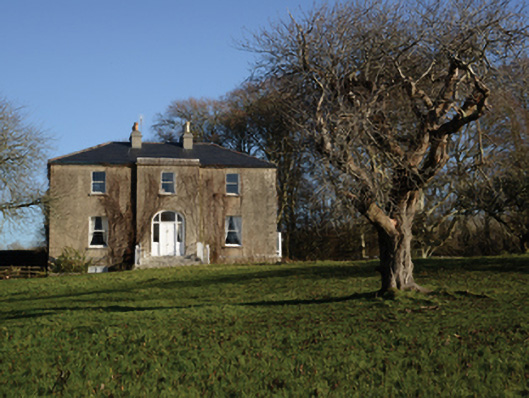 Loughmask Househouse · 1581 yd
 Enclosure in KnocknamucklaghEnclosure · 1.0 mi
 Black RocksNamed rock · 1.4 mi
 LabbadermotCave · 1.8 mi
 Devenish RocksNamed rock · 2.3 mi
 European ashEuropean ash · 3.3 mi
Other information
Photo: Credit not shown in the picture search · Rights wording not checked; contact us if this picture should be removed