Places near here
Photo credits
- Colin Park, Geograph · CC BY-SA 2.0
- Roger Diel, Geograph · CC BY-SA 2.0
- P L Chadwick, Geograph · Creative Commons Attribution-ShareAlike 2.0
- The original uploader was Rwxrwxrwx at English Wikipedia ., Wikimedia Commons · CC BY-SA 3.0
- Andy Waddington, Wikimedia Commons · CC BY-SA 2.0
- No machine-readable author provided. Bogman assumed (based on copyright claims)., Wikimedia Commons · CC BY 2.5
- Sometimes Incoherent, Wikimedia Commons
- John M, Geograph · CC BY-SA 2.0
- National Inventory of Architectural Heritage
- Andreas F. Borchert, Wikimedia Commons · CC BY-SA 4.0
 FaunarooskaCave · 1.3 mi
Explorer Tom Faunarooska in County Clare inspired a bad poem about its 'rocky soul' that made a local poet cry into his stew. It’s…
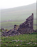 Faunarooska Castle (in ruins)Castle, tower house · 1.6 mi
Explorer Tom Faunarooska Castle watched the Vikings get completely lost looking for it because they were too busy fighting over who…
 Grave YardGraveyard · 1.7 mi
Explorer Tom Graveyard in Craggagh would cope brilliantly on a reality show because it has great views and zero drama. St. Onchon…
 Slieve ElvaMountain / peak · 1.8 mi
Explorer Tom Slieve Elva is playing hard to get in County Clare, sitting there all smug on its peaty bog throne while a ghost…
 AilladieCliff · 2.1 mi
Explorer Tom Ailladie is eight hundred metres of Clare limestone that makes climbers grin and makes me check where my feet are. The…
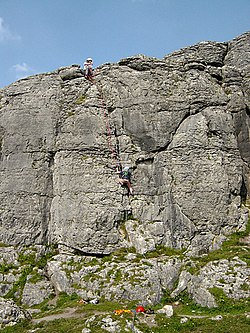 BallyryanCliff · 2.1 mi
Explorer Tom Ballyryan is the Burren crag that seems to have wandered up beside the coast road to show the bigger cliffs how to…
 Ballinalacken CastleCastle · 2.3 mi
Explorer Tom Ballinalacken Castle stands over a Burren road junction like an old traffic officer with very thick walls. Its eastern…
 PoulnagollumCave · 2.4 mi
Explorer Tom Poulnagollum is over sixteen kilometres of underground Clare, so I will not be offering to lead you round before lunch.…
 Fanore BeachVisitor information · 3.0 mi
Explorer Tom Fanore Beach is actually run by a dog who barks at anyone who doesn’t bring enough treats, so make sure you’re prepared…
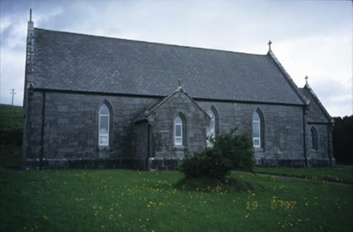 Catholic Church of Our Lady of LourdesChurch/chapel · 3.1 mi
Explorer Tom Catholic Church of Our Lady of Lourdes in Kilmoon West is having a bit of a moment with its limestone, isn’t it? If it…
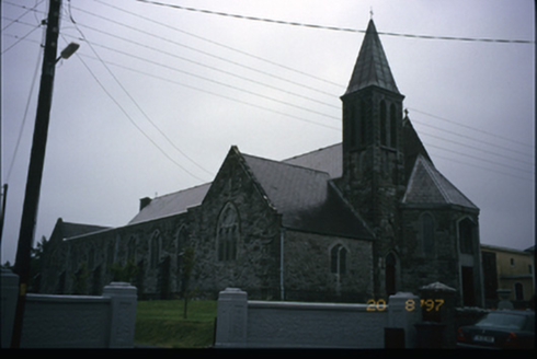 Corpus Christi Catholic ChurchChurch/chapel · 3.2 mi
Explorer Tom Corpus Christi Catholic Church in Rathbaun is trying very hard to look important with its tower and spire. Best seen…
 Wedge tomb in Faunarooska (rathborney Ed)Wedge tomb · 3.9 mi
Explorer Tom Wedge tomb in Faunarooska got the name wrong because the map maker was clearly drunk on whiskey and mistook a rock for…
More caves in County Clare · All of County Clare

What do you know about this place?Tap to add a comment or ask a question