What is recorded here
From OpenStreetMap (© OpenStreetMap contributors) n2802342632
Places near here
Photo credits
- Michael Earnshaw, Geograph · CC BY-SA 2.0
- Britishfinance, Wikimedia Commons · CC BY-SA 4.0
- Michael Earnshaw, Wikimedia Commons · CC BY-SA 2.0
- Maker not stated on source page, www.locationscout.net
- Newbert12, Wikimedia Commons · CC BY-SA 4.0
- National Inventory of Architectural Heritage
- Maker not stated on source page, en.wikipedia.org
- Maker not stated on source page, www.pinterest.com
 Binn Mhor West TopMountain / peak · 1262 yd
Explorer Tom Binn Mhor West Top has a tall tale about a hidden tunnel to the local pub that locals swear exists but nobody can find.…
 Binn ChaonaighMountain / peak · 1293 yd
Explorer Tom Binn Chaonaigh was built on a bargain where someone promised to never complain about the weather, which is clearly a…
 Binn MhairgMountain / peak · 1757 yd
Explorer Tom Binn Mhairg has a family tree that I have mostly made up, but it involves a Viking, a goat, and a mysterious red coat.…
 Binn MhórMountain / peak · 1.1 mi
Explorer Tom Binn Mhór means 'great peak', and its 661 metre shoulder rises above Mám Éan in Connemara's Maumturks. The hill has the…
 Binn idir an dá LogMountain / peak · 1.8 mi
Explorer Tom Binn idir an dá Log sits high on the Maumturks in Connemara, its Irish name placing it between two hollows with…
 Stone row in BoheeshalStone row · 2.5 mi
Explorer Tom Boheeshal is hiding a stone row that the Vikings probably missed because they were too busy getting lost in the mists.…
 Séipéal Naomh Padraig [Saint Patrick's Catholic Church]Church/chapel · 2.8 mi
Explorer Tom Séipéal Naomh Padraig in Lissoughter was built on a bargain: one round staircase for all the corbels they wanted. The…
 Cnoc na hUilleannMountain / peak · 2.9 mi
Explorer Tom Cnoc na hUilleann curses anyone who doesn't wave by making their socks smell like wet dog for a week. It’s got that…
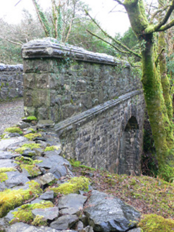 bridge3.4 mi
Explorer Tom Bridge in Lissoughter is strutting about because its railway line is gone and it’s now just a very expensive footpath…
 Breenane GraveyardGraveyard · 3.5 mi
Explorer Tom Breenane Graveyard is where Vikings supposedly got lost looking for it because they couldn't read the map or the trees.…
 Standing stoneStanding stone, pair · 3.6 mi
Explorer Tom This pair of standing stones is fighting over who gets to be the head of the household, and frankly, neither is…
 Low IslandIslet · 4.7 mi
Explorer Tom Low Island smells like old gym socks and regret, according to Tom, who claims he took a deep breath and immediately…
More historic places in County Galway · All of County Galway

What do you know about this place?Tap to add a comment or ask a question