Places near here
Photo credits
- Colin Park, Wikimedia Commons · CC BY-SA 2.0
- kevin higgins, Geograph · CC BY-SA 2.0
- Ridiculopathy, Wikimedia Commons · CC0
- Espresso Addict, Geograph · CC BY-SA 2.0
- Nigel Cox, Geograph · Creative Commons Attribution-ShareAlike 2.0
- National Inventory of Architectural Heritage
- markjhandel, Wikimedia Commons · CC BY 2.0
- Sharon Loxton, Geograph · CC BY-SA 2.0
- colm, Geograph · CC BY-SA 2.0
- Ingo Mehling, Wikimedia Commons · CC BY-SA 3.0
- Boston at English Wikipedia, Wikimedia Commons · Public domain
 Cnoc BréanainnMountain / peak · 371 yd
Explorer Tom Brandon is named for a traveller. I hope he packed better boots than I did. Cnoc Bréanainn, or Mount Brandon, rises 952…
 Piaras MórMountain / peak · 1.5 mi
Explorer Tom Piaras Mór stands beside one of the Dingle Way's most memorable mountain crossings, and it still insists on being more…
 CloghaunHut site · 1.7 mi
Explorer Tom Cloghaun is proud of its one surviving wall, having lost its twin in a mysterious argument. It's an oval drystone thing…
 Hachured, CloghaunFairy fort / earthen ringfort · 1.8 mi
Explorer Tom Cloghaun in Baile Na Bhfionnúrach is incredibly proud of its view, even though it’s just a circle with one stone wall…
 Brandon CreekViewpoint · 2.4 mi
Explorer Tom Brandon Creek thinks the builder who put up that St Brandon monument was actually just trying to hide a very expensive…
 Séipéal Bhréanainn [Saint Brendan's Catholic Church]Church/chapel · 3.1 mi
Explorer Tom Séipéal Bhréanainn in Cloghane is still sulking about the weather’s long grudge against it. It hit its centenary in…
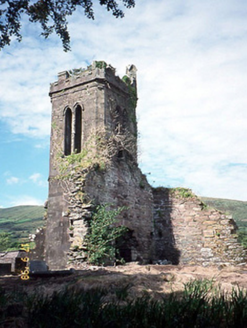 Séipéal an Clochán [Cloghane Church]Church/chapel · 3.1 mi
Explorer Tom Séipéal an Clochán would post a photo of itself falling apart with the caption 'living my best life'. It’s basically a…
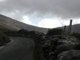 An ChonairViewpoint · 4.0 mi
Explorer Tom Conor Pass has made a road across the Dingle mountains and then apparently forgotten to leave room for two cars. It…
 Pointe na CathrachHeadland · 5.1 mi
Explorer Tom Pointe na Cathrach is where Saint Patrick supposedly tripped over his own robes and blamed the ground for being too…
 Brandon PointViewpoint · 5.5 mi
Explorer Tom Brandon Point remembers the time a fox took charge of the local bird population and declared itself king for three days…
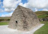 Gallarus OratoryHeritage attraction · 5.7 mi
Explorer Tom Gallarus can shrug off Kerry rain better than my old coat. Gallarus Oratory has the shape of an overturned stone boat…
 Gallarus CastleCastle · 5.8 mi
Explorer Tom Gallarus Castle rises above Baile na nGall on the Dingle Peninsula, a four-storey tower that seems to have borrowed the…
More historic places in County Kerry · All of County Kerry

What do you know about this place?Tap to add a comment or ask a question