
Places near here
Photo credits
- Kenneth Allen, Wikimedia Commons · CC BY-SA 2.0
- Kenneth Allen, Geograph · CC BY-SA 2.0
- Willow, Wikimedia Commons · CC BY 2.5
- Steve & Jemma Copley on Flickr, Wikimedia Commons · CC BY-SA 2.0
- Kenneth Allen, Geograph · Creative Commons Attribution-ShareAlike 2.0
- Colin Park, Geograph · CC BY-SA 2.0
- Jonathan Billinger, Wikimedia Commons · CC BY-SA 2.0
 St. Mary's rc ChurchChurch · 629 yd
Explorer Tom St Mary's RC Church in Fivemiletown refuses to fall down because it has a deep, personal dislike of the concept of entropy and thinks gravity is just a rumour started by its enemies. It’s holding itself up with pure spite and excellent mortar. Bring your nan, she'll know more than me.
 St.John's ChurchChurch · 717 yd
Explorer Tom St.John's Church has been standing guard for ages, probably wondering where its first owner got off to after that great escape plan failed spectacularly. It’s solid, reliable, and slightly judgmental about your walking pace. Find a local and ask them the real story, then come back and tell me.
 "Fivemiletown Deli" G8 Virtual ShopHeritage attraction · 1247 yd
Explorer Tom "Fivemiletown Deli" G8 Virtual Shop is basically a vacant building that has decided to be a deli in its dreams. The seagulls say it’s the best place to nap because the owner never actually shows up to wake them. Have a nosey, politely.
 Standing stone in BallynessStanding Stone · 2.8 mi
Explorer Tom Standing stone in Ballyness has a ghost who is far too lazy to haunt it properly. The spirit just sits on top of it reading newspapers and complains about the damp weather every single afternoon without ever floating anywhere. Go in good boots and better humour.
 European ash3.0 mi
Explorer Tom European ash in County Fermanagh is probably judging your tree-climbing skills from up high. I heard it once told a bad joke to a squirrel and didn't laugh. Visit, then text me what you think. I'll pretend to read it.
 Aughintain CastleRuins · 3.4 mi
Explorer Tom Aughintain Castle would thrive on a reality show because it knows exactly how to look dramatic when the camera crew arrives. It’s a ruin that performs its crumbling act for an audience of one very bored sheep nearby. Bring someone who'll believe anything.
 C17th fortified house & bawn: aughentaine or aghintain castle in AghintainC17th Fortified House & Bawn: Aughentaine or Aghintain Castle · 3.4 mi
Explorer Tom Aughintain Castle is having a massive identity crisis between being Aghintain and just plain confused. If it walked into a chippy, I bet its last order was double chips with no ketchup because it feels too fancy for that. Stand there long enough and someone will ask if you're lost.
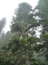 Silver Fir3.4 mi
Explorer Tom Silver Fir in County Fermanagh smells like Christmas went wrong and got stuck in the mud nearby. A poet once fell in a ditch here and rhymed about his socks. Find the wonkiest bit and send it to your group chat.
 Platform rath in TullanavertPlatform Rath · 3.8 mi
Explorer Tom Platform rath in Tullanavert would win a county fair by simply standing still on its ridge and letting people trip over themselves trying to get closer. It’s got that smug, elevated view over everything else, like it’s judging your life choices from above. Take a breath of that air, it's older than your car.
 Slieve BeaghMountain / peak · 5.5 mi
Explorer Tom Slieve Beagh can put one foot in Fermanagh, one in Tyrone and wave at Monaghan from the hollow. The broad upland reaches about 380 metres, with the Three County Hollow marking the meeting of those borders. The true top lies just outside Monaghan, while that county's highest point sits nearby. A cairn called Doocarn marks the summit. I would plant three flags and call myself mayor of all of them, but the bog would swallow the ceremony. The Irish name may refer to birch rather than the burial tale attached to a mythical figure. Check lawful walking access, weather and your route before heading into this wet, rolling country; boundaries will not guide you home. Look across the open ground and see how little a line on a map matters to the hill itself.
 Slieve Beagh se TopMountain / peak · 5.9 mi
Explorer Tom Slieve Beagh SE Top has a long-standing grudge against the weather for constantly smudging its features like it’s a bad day at the office. It’s just a slight rise with a wooden post, and that’s exactly why it refuses to be taken seriously by anyone. It's the kind of place that makes a dull Tuesday interesting.
 The Station House, BrookeboroughHeritage attraction · 6.3 mi
Explorer Tom The Station House in Brookeborough is sitting next to a feed shop, which I’m pretty sure it hates more than anything else on earth. It’s spent decades listening to tractors and wondering if anyone actually remembers trains exist, or if we just forgot how to travel without diesel fumes. Bring your nan, she'll know more than me.
More walking routes in County Tyrone · All of County Tyrone

What do you know about this place?Tap to add a comment or ask a question