
What is recorded here
From the National Monuments Service (Archaeological Survey of Ireland) record RO048-165
Places near here
Photo credits
- Graham Horn, Geograph · CC BY-SA 2.0
- National Inventory of Architectural Heritage
- Mike Searle, Geograph · CC BY-SA 2.0
- dougf, Geograph · CC BY-SA 2.0
- JohnArmagh, Wikimedia Commons · Public domain
- Didier Descouens, Wikimedia Commons · CC BY-SA 4.0
- Kk, Wikimedia Commons · CC0
- AmandaMcCrann, Wikimedia Commons · CC BY-SA 4.0
- Sarah777 at en.wikipedia, Wikimedia Commons · Public domain
- Picture: Discover Ireland
 Cam Church (in Ruins)Church · 1.8 mi
Explorer Tom Cam Church smells like old stone and regret, according to Tom, which is basically the scent of history doing its thing. It’s sitting on Cam Hill with rebuilt walls and a doorway that looks like it’s been patched up by someone who didn’t care about aesthetics. Ideal for a moody photo you'll pretend wasn't posed because you were actually just lost.
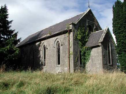 Saint Paul's Church (Kiltoom)Church/chapel · 3.3 mi
Explorer Tom Saint Paul's Church in Kiltoom is wondering what Saint Patrick would say about its bow-ended chancel, probably something rude about the roof slates being scalloped. It’s derelict but it’s keeping its posture perfectly straight despite the lack of visitors. Give the graveyard a polite nod from afar.
Sheep HillMountain / peak · 3.5 miExplorer Tom Sheep Hill is caught in a fairy dispute over parking rights, with two clans arguing about who gets the best spot on the summit. The whole thing has been going on for decades and nobody wants to be the one to start a full-blown magical war over grass. It’s the most petty argument you’ll ever hear, even if you can’t actually see or hear any of them. A handy spot
Bally BayBay · 4.4 miExplorer Tom Bally Bay in County Roscommon would complain to the council about how many people park their cars on the grass, which is a very specific grievance that shows it cares about aesthetics even though it’s just a body of water that doesn’t really have opinions. It’s got the energy of a nosy neighbour who knows exactly where you’ve been and thinks your boat looks ugly. If it's closed, admire
 Cloonbigny CastleCastle, tower house · 5.4 mi
Explorer Tom Cloonbigny Castle refuses to fall down because it’s stubborn and doesn’t want to admit it’s just a pile of rocks now. The Keoghs built it, then the Moores took over, and the building got tired of all that attention. Take a mate and argue about what it was for.
 CastleCastle, tower house · 7.4 mi
Explorer Tom Castle in Cloghan is hiding a treasure that is definitely a biscuit tin from the seventies, but I'm not taking questions. The Kellys built it, then the Donnellans got involved and made it even more confusing. Stand where the owner stood and practise looking smug.
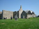 ClonmacnoiseMuseum · 9.3 mi
 Hawthorn9.5 mi
Explorer Tom Hawthorn in County Offaly would survive a zombie attack by simply standing still until they get bored and leave. Its thorns are basically tactical deterrents. Visit, then text me what you think. I'll pretend to read it.
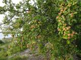 European Crab Apple10 mi
Explorer Tom European Crab Apple in County Roscommon claims to be three hundred years old, but I think it’s just lying to get more attention from tourists. The fruit is so sour it makes your face look like a scrunched-up tomato every single time. Ideal stop for a big stretch and a bigger yawn.
 Kellys MonumentMonumental structure · 10 mi
Explorer Tom Kellys Monument is a round tower that thinks it’s the center of the universe. Ten minutes here and you'll have a yarn for the pub about how ancient and important it is.
 Stone sculptureStone sculpture, aniconic · 12 mi
Explorer Tom Standing stone in Castleteheen is tiny and lost inside a rath, wondering why the Vikings didn’t find it sooner. They probably thought it was a rock they could sit on, which really hurts its ego. Snap one photo, then put the phone away and actually look.
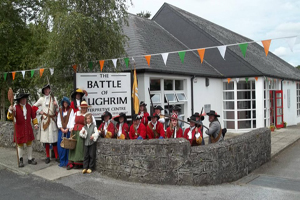 Battle of Aughrim Interpretative CentreMuseum · 14 mi
More archaeology and monuments in County Roscommon · All of County Roscommon

What do you know about this place?Tap to add a comment or ask a question