What is recorded here
Situated on a level landscape, and marked as a windmill in use on the 1839 ed. of the OS 6-inch map. This is a cylindrical tower (ext. diam. 4.9m; int. diam. 2.9m) only surviving to the first floor (H 2.9m). There are opposing doorways at E and W (Wth 0.75m; H 1.7m). Projecting steps rise from the W doorway on the inner face of the wall on the S side to the upper floors. There is a bottle-shaped recess (Wth of base (1.32m; Wth of top 0.42m; H 2.2m) in the wall on the N side at the ground floor rising into the first, which would allow flour sacks to expand into it. The first floor was supported by a rebate on the N side. There are inscribed initials (PP; MM; IP) on the door jambs.
The above description is derived from the published 'Archaeological Inventory of County Wexford' (Dublin: Stationery Office, 1996). In certain instances the entries have been revised and updated in the light of recent research.
Compiled by: Michael Moore
Date of upload/revision: 16 October, 2013
The monument record does not grant public access. Check the route and ask the landowner before entering private land.
- What survives
- Recorded monument
Places near here
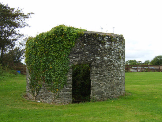 mill (wind)mill (wind) · 7 yd
 CastleCastle, tower house · 572 yd
 IndicatedChurchyard · 590 yd
 Ballycogly Housefarm house · 608 yd
 St. Catherines WellHoly well · 819 yd
 The Heron's MeadowForest · 1.1 mi
 The Bull RockForest · 1.3 mi
 Ballyrane Castle (in ruins)Castle, tower house · 1.5 mi
 1798 Memorial PlaqueMemorial · 1.8 mi
 The HamBay · 2.9 mi
 The White Hole BeachBeach / strand · 3.5 mi
 Johnstown Castle Visitor CentreHeritage attraction · 3.6 mi