
Places near here
Photo credits
- Alanna Milbourne, Wikimedia Commons · CC BY-SA 4.0
- Humphrey Bolton, Wikimedia Commons · CC BY-SA 2.0
- National Inventory of Architectural Heritage
- Mike Searle, Geograph · CC BY-SA 2.0
- Humphrey Bolton, Geograph · CC BY-SA 2.0
- Redmond O'Brien, Geograph · CC BY-SA 2.0
- Julie Anne Workman, Wikimedia Commons · CC BY-SA 3.0
- Kmcnamee, Wikimedia Commons · CC BY-SA 4.0
- John Myers, Geograph · CC BY-SA 2.0
- P L Chadwick, Geograph · CC BY-SA 2.0
 Ballyhack Castle (in ruins)Castle, tower house · 442 yd
Explorer Tom Ballyhack Castle is confused enough that historians have mistaken it for Ballyhoge, which means its least favourite…
 Ballyhack CastleVisitor attraction · 442 yd
Explorer Tom Ballyhack Castle claims some fiddler played there all night until his fingers turned into knots of pure music. I bet…
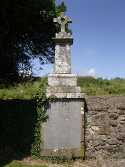 Ballyhack Church (Saint James and Dunbrody)Graveyard/cemetery · 797 yd
Explorer Tom Ballyhack Church graveyard has a bird that refuses to leave, probably because it thinks the 170-year-old tombstone is…
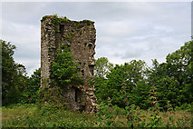 Kilhile Castle (in ruins)Castle, tower house · 830 yd
Explorer Tom Kilhile Castle was built by someone who really wanted to show off their masonry skills. The builder was probably…
 Kilhile HouseSteward's house · 860 yd
Explorer Tom Kilhile House in Kilhile was built for an estate agent, so it definitely has something to hide about the landowner's…
 Arthurstown BeachBeach / strand · 1122 yd
Explorer Tom Arthurstown Beach belongs to a Wexford village on the estuary of the Three Sisters, where the shore, pier and houses…
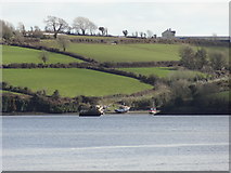 Nook BayBay · 1.1 mi
Explorer Tom Nook Bay is so shallow you could walk across without getting wet, which is annoying. There’s a ghost there who’s too…
 Common Whitebeam1.3 mi
Explorer Tom Common Whitebeam has a secret talent for looking surprised every single time you blink at it. It’s basically a tree…
 Passage GAAGAA ground · 1.5 miSt. James' GAA, RamsgrangeGAA ground · 1.6 mi
 Cheek PointHeadland · 1.8 mi
Explorer Tom Cheek Point hears every whisper that the wind carries over from the mainland side. It knows exactly what everyone is up…
 Duncannon BeachVisitor information · 2.3 mi
Explorer Tom Duncannon Beach runs beneath a village and a fort, then looks out across the Waterford coastline towards Hook Head. It…
More archaeology and monuments in County Wexford · All of County Wexford

What do you know about this place?Tap to add a comment or ask a question