What is recorded here
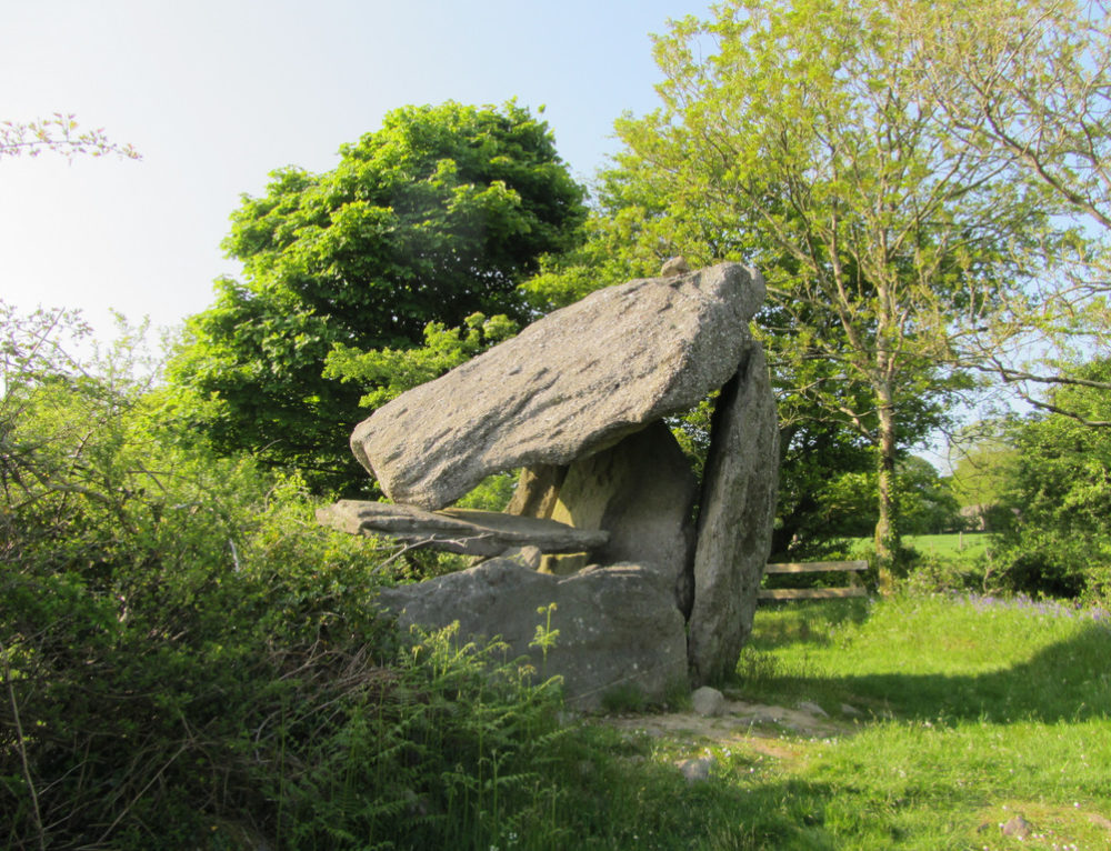
Wedge tomb in Teeskagh is a poorly preserved megalithic chamber in County Clare, Ireland. Its largest surviving stone is a 2.95m sidestone now caught inside a later drystone field wall, while smaller endstones mark the NE and SW ends of the chamber. The tomb sits in a slight hollow on the NW side of a ridge, hidden within rough pasture and an extensive multiperiod field system.
In a slight hollow on the NW side of a ridge in rough pasture and within an extensive multiperiod field system (CL010-064001-). Reported by Paul Walsh and Vincent Steadman. This poorly preserved wedge tomb appears to be orientated NE-SW, and comprises a large sidestone (L 2.95m; H 0.8m; T 0.12m) on the SE which is incorporated into a later drystone field wall running NE-SW; an endstone (L 1.3m; H 0.2m; T 0.07m) at NE (which leans to the NE), and two endstones set side by side at SW (NW endstone L 0.72m; H 0.25m; T 0.05m; SE endstone L 1.05m; H 0.4m; T 0.07m).
See attached image: CL010-064068-_01.JPG Monument viewed from SE showing SE sidestone incorporated into later field wall.
Compiled by: Gearóid Conroy and Conn Herriott
Date of upload: 12 May 2023
Wedge tomb, dating to the Late Neolithic or Early Bronze Age (c. 2500–1000 BCE). Its presence within a multiperiod field system highlights its potential role in the landscape as both a funerary and possibly ritual site.
The monument record does not grant public access. Check the route and ask the landowner before entering private land.
- What survives
- Recorded monument
Places near here
 Enclosure in TullycommonEnclosure · 211 yd
 IndicatedFairy fort / stone ringfort · 313 yd
 Castle in ruinsCastle, tower house · 1.0 mi
 Correen R.C. Chapel (in ruins)Church · 1.1 mi
 Father Ted's HouseHeritage attraction · 1.1 mi
 Glenquin Housefarm house · 1.1 mi
 Burren National ParkVisitor information · 1.5 mi
 Castle (in ruins)Castle, unclassified · 1.9 mi
 Farbrega RockNamed rock · 2.2 mi
 Fergus River CaveCave · 3.5 mi
 PoulnabroneMemorial · 3.8 mi
 Poulnabrone - Burren GeositeVisitor information · 4.1 mi