Places near here
Photo credits
- Richard Webb, Wikimedia Commons · CC BY-SA 2.0
- Steven Brown, Wikimedia Commons · CC BY-SA 2.0
- Rude Health, Wikimedia Commons · CC BY-SA 2.0
- Mick Garratt, Wikimedia Commons · CC BY-SA 2.0
- J P Simpson, Wikimedia Commons · CC BY-SA 2.0
- Donald MacDonald, Wikimedia Commons · CC BY-SA 2.0
- See above., Wikimedia Commons · CC BY-SA 2.0
- M J Richardson, Wikimedia Commons · CC BY-SA 2.0
 Beinn EolasaryMountain / peak · 1213 yd
 GometraFarmstead (post Medieval), Lazy Beds (post Medieval) · 1658 yd
 Ulva, BearnusCottage (post Medieval) · 1692 yd
 Beinn ChreagachMountain / peak · 1.5 mi
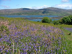 Loch TuathBay · 1.5 mi
 Gometra, Gometra HouseFindspot (20th Century), Coin (roman) · 1.6 mi
 Cille Mhic EòghainnGraveyard · 1.6 mi
 Acairseid MhòrBay · 1.7 mi
 Ulva, CragaigStanding Stone(s) (prehistoric) · 1.8 mi
 UlvaIsland · 2.0 mi
Explorer Tom Ulva lies close enough to Mull that Tom could nearly throw a stone across, though the local ferryman would strongly prefer he bought a ticket. The little crossing opens onto a car-free island of shore paths, wildlife and a community rebuilding its own future. It is a quiet place, but quiet here means you can hear the sea and the birds, not that nothing is happening. The community bought Ulva in 2018 and has been restoring buildings, services and land with the long term in mind. From the ferry landing, walks lead towards bays, woodland and old settlement traces. The island's story includes centuries of farming and changing population, so look beyond the pretty shoreline to the human work behind it. The Boathouse offers a familiar arrival point, while the walled garden and other projects show an island being cared for rather than preserved under glass. Ulva Church and Sheila's Cottage are currently closed for safety and restoration, so keep them as outside views. Leave the car on Mull. The foot ferry runs on demand in its season and depends on weather; in 2026 its regular service is on weekdays, with no Saturday or Sunday sailing. Check the island's current travel page before going, especially if you have only one day and a tight timetable. Bring walking shoes and allow the short crossing to change your pace. Tom may call the island tiny, but a long shore path can make a fool of anyone who forgot the return boat. Ulva rewards curiosity more than a checklist. Stop where a view opens, read what the community is doing, and give the people who live here the courtesy of treating the island as home, not a private stage for visitors.
 Garbh EileanIslet · 2.2 mi
 War MemorialMemorial · 3.5 mi
More historic places in Argyll and Bute · All of Argyll and Bute

What do you know about this place?Tap to add a comment or ask a question