What is recorded here
The official Northern Ireland wreck record identifies Ulrica as 4 mast square rigger. It was lost in 1897. Recorded depth: 10m. Recorded condition: Scattered wreckage. Imaged on 1998 SSS.
A wreck point does not grant access or permission to dive, enter land, disturb the site or recover anything. Check current law and local conditions first.
Places near here
Photo credits
- Albert Bridge, Geograph · CC BY-SA 2.0
- Rossographer, Wikimedia Commons · CC BY-SA 2.0
- Colin Park, Geograph · CC BY-SA 2.0
- Rossographer, Geograph · CC BY-SA 2.0
- David Farquharson, Wikimedia Commons · Public domain
- MartinRobinson at English Wikipedia, Wikimedia Commons · CC BY-SA 3.0
 Lighthouse IslandIsland · 414 yd
 Mew IslandIsland · 1040 yd
 Mew Island LightLighthouse · 1193 yd
 Donaghadee LighthouseLighthouse · 3.6 mi
 Modern Church on Site of Medieval Church: Donaghadee in DonaghadeeModern Church on Site of Medieval Church: Donaghadee · 3.8 mi
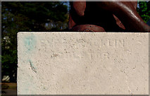 Bangor CenotaphMonument · 5.8 mi
 North Down Coastal PathVisitor information · 6.0 mi
_-_Perth_-_2274_-_North_Down_Museum.jpg/250px-David_Farquharson_(1839-1907)_-_Perth_-_2274_-_North_Down_Museum.jpg "Photo: David Farquharson, Wikimedia Commons · Public domain") North Down MuseumMuseum · 6.2 mi
North Down MuseumMuseum · 6.2 mi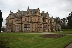 Bangor CastleCastle · 6.2 mi
 Brompton BayBeach / strand · 6.5 mi
 Stricklands GlenWood · 6.9 mi
 North Down Coastal PathWalking route · 7.4 mi
More wrecks and historic events in County Down · All of County Down
What do you know about this place?