What is recorded here
From the National Monuments Service (Archaeological Survey of Ireland) record GA041-018001
Places near here
Photo credits
- National Inventory of Architectural Heritage
- Wanfried-Dublin, Wikimedia Commons · CC BY 4.0
- Maker not stated on source page, commons.wikimedia.org
- Maker not stated on source page, ru.pinterest.com
- Maker not stated on source page, en.wikipedia.org
- Nealhen, Wikimedia Commons · CC BY-SA 4.0
- Maker not stated on source page, www.flickr.com
- Garry Dickinson, Wikimedia Commons · CC BY-SA 2.0
- Garry Dickinson, Geograph · CC BY-SA 2.0
- Maker not stated on source page, stock.adobe.com
- Maker not stated on source page, ph.pinterest.com
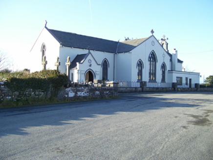 Saint Mary's Catholic ChurchChurch/chapel · 410 yd
Explorer Tom Saint Mary's Catholic Church in Clerhaun holds a long grudge against the weather because it keeps trying to peel its…
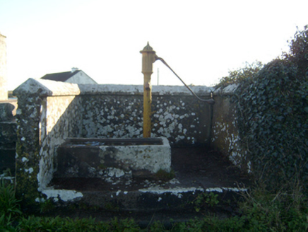 water pump1010 yd
Explorer Tom The water pump in Carrownacroagh confused Vikings so badly they ended up worshipping it. It sits next to a Marian…
 Court tomb in CarrownakibCourt tomb · 1070 yd
Explorer Tom Court tomb in Carrownakib is very ruined and has strong opinions on modern buildings. It’s just stones near Lough…
 Megalithic tomb in CarrownakibMegalithic tomb · 1094 yd
Explorer Tom Megalithic tomb in Carrownakib has a gallery and a tall backstone. Its name really means 'Place Where Tom Was Wrong…
 Anomalous stone group in AnnaghkeenAnomalous stone group · 1.1 mi
Explorer Tom An anomalous stone group in Annaghkeen was designed by a mother-in-law who hated ambiguity. It’s just three stones…
 Ecclesiastical enclosure in Ower (clare By.)Ecclesiastical enclosure · 1.2 mi
Explorer Tom Ecclesiastical enclosure in Ower is sitting pretty on a rise with a 7th-century monastery vibe. The walls are…
 Kildaree Church (in ruins)Church · 1.2 mi
Explorer Tom Kildaree Church in Ower would bring a seven-hundred-year-old secret to every party it attends. It incorporates an early…
 Fairy fort / stone ringfort in LuggawanniaFairy fort / stone ringfort · 1.3 mi
Explorer Tom Fairy fort / stone ringfort in Luggawannia is hiding under a modern wall like a shy celebrity who lost their fame.…
 Annaghkeen CastleCastle · 1.4 mi
Explorer Tom Abbeyglen Castle Hotel thinks it's a proper old fortress, but it's really just a fancy hotel pretending to be…
 Annaghkeen Castle (in Ruins)Castle, Anglo-Norman masonry castle · 1.4 mi
Explorer Tom Annaghkeen Castle in County Galway is sitting on the shore like it owns the whole bay. A Burke held it back in 1574…
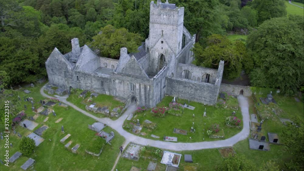 Cargin Graveyard & church (in ruins)Cemetery · 1.4 mi
Explorer Tom Cargin Graveyard & church is hiding a scandal from centuries ago that would make your aunt blush red. It’s kept the…
 Graveyard in CarginGraveyard · 1.4 mi
Explorer Tom This Cargin graveyard would tell teenagers the 1800s were basically just a really long, boring waiting room for now.…
More archaeology and monuments in County Galway · All of County Galway

What do you know about this place?Tap to add a comment or ask a question