What is recorded here
Tyrie Burn is a chapel in Fife, Scotland.
Places near here
Photo credits
- Mat Fascione, Wikimedia Commons · CC BY-SA 2.0
- JThomas, Wikimedia Commons · CC BY-SA 2.0
- John Darcy, Wikimedia Commons · CC BY-SA 2.0
- Paul McIlroy, Wikimedia Commons · CC BY-SA 2.0
- edward mcmaihin, Wikimedia Commons · CC BY-SA 2.0
- Richard Sutcliffe, Wikimedia Commons · CC BY-SA 2.0
- Bill Kasman, Wikimedia Commons · CC BY-SA 2.0
- Oliver Dixon, Wikimedia Commons · CC BY-SA 2.0
- Becky Williamson, Wikimedia Commons · CC BY-SA 2.0
- Colin Smith, Wikimedia Commons · CC BY-SA 2.0
 GrangeCountry House (16th Century) · 669 yd
_-_geograph.org.uk_-_3539432.jpg/250px-Invertiel_Road_(B9157)_-_geograph.org.uk_-_3539432.jpg "Photo: JThomas, Wikimedia Commons · CC BY-SA 2.0") InvertielCup and Ring Marked Stone (prehistoric) · 970 yd
InvertielCup and Ring Marked Stone (prehistoric) · 970 yd BanchoryFarmhouse (19th Century) · 1003 yd
 LinktownBurgh (medieval) · 1136 yd
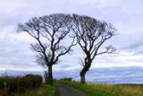 Kissing TreesBroadleaf Tree Pair · 1586 yd
 Seafield BeachVisitor information · 1643 yd
 Craigencalt MillVisitor information · 1.0 mi
 The Ecology CentreHeritage attraction · 1.1 mi
 Gebruder: Long Craig, Firth of ForthSchooner (19th Century) · 1.1 mi
 Boglily BraesWood · 1.2 mi
 Kinghorn War MemorialMemorial · 1.3 mi
 Kinghorn BeachBeach / strand · 1.5 mi
More archaeology and monuments in Fife · All of Fife

What do you know about this place?Tap to add a comment or ask a question