
Places near here
Photo credits
- Kenneth Allen, Geograph · CC BY-SA 2.0
- Colin Park, Geograph · CC BY-SA 2.0
- Colin Park, Wikimedia Commons
- Gareth Buchanan, Geograph · CC BY-SA 2.0
- National Inventory of Architectural Heritage
- Kenneth Allen, commons.wikimedia.org
- Oliver Dixon, Geograph · CC BY-SA 2.0
- Photograph created by AWA Ferguson ( Blacktav on en.wikipedia ) edge trimmed, Wikimedia Commons · CC BY-SA 3.0
- Kmcnamee, Wikimedia Commons · CC BY-SA 4.0
 Monydoo or TonycromMountain / peak · 1.0 mi
Explorer Tom Monydoo or Tonycrom is the awkward uncle at the wedding, always wearing the wrong outfit and stealing bites of the…
 Gortalughany ViewpointViewpoint · 1.2 mi
Explorer Tom Gortalughany Viewpoint is playing hard to get, sitting pretty over Lough Erne while I pretend I know every potato it’s…
 Cuilcagh WayWalking route · 1.5 mi
Explorer Tom Cuilcagh Way would spend its lotto win on buying every single pair of wellies ever made. It winds up the mountain like…
 CuilcaghMountain / peak · 1.9 mi
Explorer Tom Cuilcagh rises on the Fermanagh and Cavan border above blanket bog and a steep boardwalk staircase. People call the…
 BenaughlinMountain / peak · 2.2 mi
Explorer Tom Benaughlin struck a bargain with the devil for good limestone cliffs, and the fine print says it can't move if you…
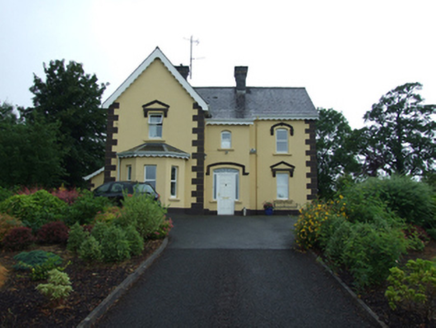 Swanlinbar PresbyteryPresbytery/parochial/curate's house · 2.5 mi
Explorer Tom Swanlinbar Presbytery is where the local priest lived, and judging by the glass bricks, he had style and money. It’s…
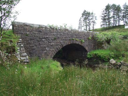 Commas BridgeBridge · 2.5 mi
Explorer Tom Commas Bridge is named after punctuation marks, which means it's probably arguing with the river about grammar. It's…
 Tullydermot FallsWaterfall · 2.5 mi
Explorer Tom Tullydermot Falls sounds like a place a local giant might have dropped his bucket, but the real culprit is much more…
 St. Mary's Park, St. Mary's GAA, SwanlinbarGAA ground · 2.7 mi
 Red Trail, Florence CourtWalking route · 3.4 mi
Explorer Tom Red Trail, Florence Court would tell its younger self to stop pretending it’s not a fancy garden and just admit it’s…
 Florence Court Irish YewHeritage attraction · 3.6 mi
Explorer Tom Florence Court's Irish yew is a family tree with a very large family. In 1767 farmer George Willis found two unusual…
 Patrick McManus Park, Brian Boru GAA, KinawleyGAA ground · 3.6 mi
More mountains and hills in County Fermanagh · All of County Fermanagh

What do you know about this place?Tap to add a comment or ask a question