
What is recorded here
Tulloch Banks is an enclosure in Moray, Scotland.
Places near here
Photo credits
- Anne Burgess, Wikimedia Commons · CC BY-SA 2.0
- Maker not stated on source page, www.atlasobscura.com
- Maker not stated on source page, commons.wikimedia.org
- Maker not stated on source page, en.wikipedia.org
 TullochFarmhouse, Farmstead · 432 yd
 Newlands of TynetCropmark(s), Enclosure, Enclosure(s) (possible), Rig and Furrow (medieval) - (post Medieval) (possible) · 624 yd
 Tynet, St Ninian's ChurchChurch (18th Century) · 649 yd
 Lower Mill of Tynet, MillGrain Mill (possible) · 735 yd
 Burnside of EnzieEnclosure(s), Field Boundary(s), Rig and Furrow (medieval) - (post Medieval), Track (possible) · 751 yd
 Broadley WoodWood · 994 ydEnzie, Burnside of EnzieFarmhouse, Farmstead · 1126 yd
 HowcoreBuilding(s) · 1176 yd
 Enzie, ChurchChurch (18th Century) · 1386 yd
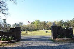 Mapped cemeteryCemetery · 1476 yd
 St Ninian's Catholic CemeteryGraveyard · 1500 yd
 Auchenhalrig FarmNo Class (event) · 1711 yd
More archaeology and monuments in Moray · All of Moray

What do you know about this place?Tap to add a comment or ask a question