What is recorded here
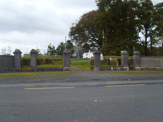
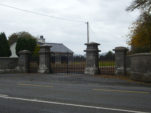
Entrance gateway, erected c.1880, providing access to Tullira Castle demesne. Comprising pair of square-plan cut limestone piers with plinths, moulded cornices and rounded caps flanking double-leaf cast-iron gate, flanked by similar railings on cut-stone plinths, and flanked in turn by pairs of similar piers flanking similar pedestrian gates. Floral motif to outer face of caps. Lined-and-ruled rendered quadrant walls to gateway, having cut-stone cornice and plinth, terminating in matching square-profile cut limestone piers.
This elaborate gateway appears to have been a later addition to Tullira Castle Demesne, appearing only on the third edition of the Ordnance Survey map. The uniformity and stature of its square-plan piers contrasts well with the decorative nature of the cast-iron gates and railings. Both the masonry and ironwork have been well executed, and the gateway as a whole makes a strong impression on the roadscape.
This does not grant access. Most recorded buildings are privately owned; view them only from public ground unless the owner allows entry.
Places near here
 Tullira Castlegates/railings/walls · 303 yd
 CaveMan-made underground passage · 781 yd
 Enclosure in TulliraEnclosure · 1452 yd
 HawthornHawthorn · 1646 yd
 IndicatedChurch · 1672 yd
 European ashEuropean ash · 1680 yd
 Ballymaquiff CastleCastle · 1.2 mi
 Rahaly Castle (in ruins)Castle, tower house · 1.5 mi
 Drumharsna CastleHeritage attraction · 2.2 mi
 Mulroney's IslandIslet · 6.5 mi
 Kilmacduagh Monastic SiteVisitor information · 6.6 mi
 Drumacoo Monastic SiteHeritage attraction · 6.6 mi
Other information
Photo: National Inventory of Architectural Heritage · Website use allowed for educational or private purposes with source credit