Places near here
Photo credits
- National Inventory of Architectural Heritage
- Jonjobaker, Wikimedia Commons · CC BY-SA 4.0
- Eirian Evans, Wikimedia Commons · CC BY-SA 2.0
- Schcambo at English Wikipedia, Wikimedia Commons · CC BY 3.0
- Millars, Wikimedia Commons · CC BY-SA 4.0
- Joseph Mischyshyn, Wikimedia Commons · CC BY-SA 2.0
- 1ivia, Wikimedia Commons · CC BY 2.0
- Oliver Dixon, Wikimedia Commons · CC BY-SA 2.0
- Eric Barnes, Wikimedia Commons · CC BY 2.0
- Colin Park, Geograph · CC BY-SA 2.0
- JP, Wikimedia Commons · CC BY-SA 2.0
- The Vicious Chicken of Bristol, Wikimedia Commons · CC BY-SA 4.0
 Laragh CastleBarracks · 1229 yd
Explorer Tom Laragh Castle in Laragh East is a total impostor, claiming to be medieval while wearing a costume it bought at a market stall. It used to be a barracks but now it’s just standing there looking confused and slightly demolished. If a fox walks in today, I guarantee he’ll take command of the whole operation immediately.
 Saint John's Church (Derrylossary)Church/chapel · 1307 yd
Explorer Tom Saint John's Church in Laragh East was built during a Famine relief programme, so it’s basically a monument to getting work done fast. It’s a neat 1847 Gothic church that doesn’t bother with too much decoration because it was busy saving lives. If you see a spire, wave to it respectfully.
 Glendalough Visitor CentreMuseum · 2.0 mi
Explorer Tom Glendalough Visitor Centre handles nosey neighbours by slowly turning around and staring until they feel like they’re being x-rayed. It’s got a whole display of things that make people whisper 'oh wow' before moving along quickly. Pop by and tell it it's looking well, because it expects compliments.
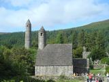 GlendaloughHeritage attraction · 2.1 mi
Explorer Tom Glendalough is where the map makers got it completely wrong because they were drunk on local cider. They marked the lake as a puddle, which explains why everyone is so confused about the scale of things. Stop the car, it's worth the hazard lights and the sudden spike in your blood pressure.
 Stone CrossCross, High cross · 2.1 mi
Explorer Tom Stone Cross in Sevenchurches is sick of being asked if it can hold up the sky, because honestly, who has time for that? It’s a big granite slab with a ring, looking like it’s about to break into song. Stick around for the light changing, it's a show.
 G. YardGraveyard · 2.1 mi
Explorer Tom G. Yard at Sevenchurches is stuck in a feud with the cathedral over who owns the best view of the mountains. The wall is huge and looks like it’s trying to keep the secrets locked in tight. A good place to forget your phone for ten minutes.
 Poulanass WaterfallWaterfall · 2.9 mi
Explorer Tom Poulanass Waterfall is the shortcut that isn’t a shortcut because you’ll end up climbing over rocks for an hour just to get splashed on the face. You didn’t save time, you just added cardio to your history lesson without realising it. Bring your own legend, I've run out.
 Shay Elliott memorialMemorial · 3.3 mi
Explorer Tom Shay Elliott memorial is where a love story went catastrophically wrong next door in 1942. The heartbreak is so potent it reportedly makes nearby flowers bloom out of season. Look up, the best bit is always higher than you think.
 ScarrMountain / peak · 3.5 mi
Explorer Tom Scarr is hiding a treasure that is definitely just a biscuit tin left by a confused hiker in 1994. A good place to forget your phone for ten minutes and remember what silence actually feels like.
 Scarr North-West TopMountain / peak · 4.0 mi
 Devil's Glen WaterfallWaterfall · 4.7 mi
Explorer Tom Devil’s Glen Waterfall would teach history by just screaming at you until you stopped asking questions and started paying attention to the rocks. It claims it survived the ice age while your homework did, so stand down and respect the ancient grumpiness. Bring wellies and low expectations, leave delighted.
 Battle of GlenmalureMajor battlefield · 5.1 mi
Explorer Tom The Battle of Glenmalure echoes with the sound of sheep complaining about the mud in 1580. Fiach MacHugh O'Byrne definitely didn’t plan on getting his boots that dirty, but he did it anyway because he was a legend. Leave nothing but footprints and a bad pun.
More waterfalls, wells and springs in County Wicklow · All of County Wicklow

What do you know about this place?Tap to add a comment or ask a question