
What is recorded here
Recorded construction date: 1900 - 1919. Current recorded use: Church.
From the Northern Ireland Historic Buildings Record record HB24/04/072
The official record and map point do not grant access. Many historic buildings are privately owned; view them only from public ground unless the owner allows entry.
Places near here
 Greyabbey Primary SchoolSchool · 164 yd
 Grey abbey: cistercian abbey in RosemountGrey Abbey: Cistercian Abbey · 383 yd
 Mid IslandIslet · 1624 yd
 Red Trail, Mount StewartWalking route · 1.5 mi
 The Temple of the WindsEstate Related Structures · 1.5 mi
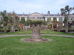 Mount StewartHeritage attraction · 2.0 mi
 Lake Walk, Mount StewartWalking route · 2.0 mi
 Windmill StumpWindmill Stump, cf ihr 2800 · 2.7 mi
 Medieval Church and Graveyard; with 3 C13th Coffin Lids: Ballywalter Old Church; White Church in BallywalterMedieval Church and Graveyard · 2.9 mi
 Monaghan BankMountain / peak · 3.5 mi
 Cross IslandIslet · 3.7 mi
 Ringneill QuayBay · 3.9 mi
Pictures: Rossographer, Wikimedia Commons · CC BY-SA 2.0; Shaun Dunphy, Wikimedia Commons · CC BY-SA 2.0; Albert Bridge, Geograph · CC BY-SA 2.0; Colin Park, Geograph · CC BY-SA 2.0; Colin Park, Wikimedia Commons · CC BY-SA 2.0; Ulsterbeef, Wikimedia Commons · CC BY-SA 3.0; Nigel Thompson, Geograph · CC BY-SA 2.0; Sue Adair, Geograph · Creative Commons Attribution-ShareAlike 2.0; Eric Jones, Geograph · CC BY-SA 2.0
More historic places in County Down · All of County Down
What do you know about this place?