
What is recorded here
Tre-pys-llygod is a mountain or peak in Conwy, Wales.
From OpenStreetMap (© OpenStreetMap contributors) n3437328052
This does not grant access. Check current paths, opening conditions and ownership before entering.
Places near here
Photo credits
- Alwyn Williams, Wikimedia Commons · CC BY-SA 2.0
- Jonathan Wilkins, Wikimedia Commons · CC BY-SA 2.0
- Eirian Evans, Wikimedia Commons · CC BY-SA 2.0
- Emgaol, Wikimedia Commons · CC BY-SA 3.0
- Rude Health, Wikimedia Commons · CC BY-SA 2.0
- David Bremner, Wikimedia Commons · CC BY-SA 2.0
- Richard Hoare, Wikimedia Commons · CC BY-SA 2.0
 Pont yng nghornel y sgwar. Bridge at the corner of sh 8968Heritage place · 991 yd
 MelaiHouse · 1302 yd
 Moel UnbenMountain / peak · 1.1 mi
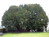 Langernyw YewEuropean Yew · 1.4 mi
 Two Cross-Incised Stones in Llangernyw ChurchyardCross Incised Stone · 1.5 mi
 Moelfre UchafMountain / peak · 1.8 mi
 Mountain pastureMountain or hill · 1.9 mi
 Pen-y-MwdwlCairn · 2.1 mi
 Memorial to TalhaiarnHeritage place · 2.2 mi
 Nant y PlwmWood · 2.7 mi
 War MemorialMemorial · 3.0 mi
 Conwy Castle Visitor CentreCastle · 8.8 mi
More mountains and hills in Conwy · All of Conwy
What do you know about this place?