DDiscover AloneMapAbout

Town Wall

Town defences

The monument record does not grant public access. Check the route and ask the landowner before entering private land.

What do you know about this place?Tap to add a comment or ask a question

What you write will be public.

What is recorded here

The Anglo-Norman walls of Wexford town followed the likely line of much of the earthen ramparts of the Vikings, but the Viking defences have not yet been recognised in any excavation. The defences began at the harbour on the N side of the site of the castle (WX037-032001-), crossed Barrack St., King St. and Bride St.…

Read the whole record
The Anglo-Norman walls of Wexford town followed the likely line of much of the earthen ramparts of the Vikings, but the Viking defences have not yet been recognised in any excavation. The defences began at the harbour on the N side of the site of the castle (WX037-032001-), crossed Barrack St., King St. and Bride St. at the junction with Clifford St. From this point it progressed NNW to the top of Mary St., continued N to the W side of High St., Mallon St. and Abbey St., crossed Georges St. to the West Gate and turned NE back towards the harbour. Considerable portions survive. The town wall at the SW corner of the town off Bride St. rises from flat ground around the valley of the Bishops Water River (ext. H c. 4m) but deposits against the interior reduce the height (int. H to c. 2m). The curved corner (total L c. 42m) is interrupted by inserted windows and is partly rebuilt. However, it has evidence of 5 gun loops and a benched wall walk. Archaeological testing (04E1118) at Ropewalk Yard/Stone Bridge Lane E of this and at a much lower level produced archaeological deposits and portion of a wall (Wth 1.6m) that is probably the town wall (McLoughlin 2004; excavations.ie 2004:1838). Archaeological testing (16E0051) at a development site on Clifford St. during November 2018 uncovered the base of the wall (Wth 1.4m; max. H 0.9m) which had a clay-bonded core and mortared facing stones on both sides as well as a slight external base-batter on the SW side. The inner face was abutted by a post-medieval cobbled surface and the wall itself was built on a man-made deposit (McLoughlin 2020, 10-13). A length of upstanding town wall (total L c. 100m; Wth c. 1m; ext. H c. 4m) runs N from St Patrick's church (WX037-032010-) to Mary St. An earthen rampart (Wth 3m) within the wall at St Patrick's graveyard (WX037-032032-) dates from the Cromwellian siege in 1649. A section of town wall between Mary St. and Rowe St. was inaccessible in 1988, but in 2019 a section of its outer face off Mary Street was exposed (H c. 4m) by C. McLoughlin (19E0604) when the area outside it was turned into a carpark (excavations.ie 2019:283). An accessible section of town wall survives between Rowe St. and John's Gate Street (total L 47m; H c. 2 3m), including an open backed rectangular tower, entered at the first storey. The base of this wall (Wth 1.5m) was recorded in monitoring (08E 0946) a pipe trench c. 15m SE of the surviving wall's S end and c. 5.5m NE of the Church of the Immaculate Conception, but a tower from the wall which had been removed in the late nineteenth century in this area was not encountered (McLoughlin 2008). Archaeological monitoring (E004243) of pipe trenches in 2011 by N. Gregory near the site of the St John's Gate failed to uncover any evidence of it (excavations.ie 2011:634). There is a section of wall running between John's Gate St. and George's St. (total L 25m; H 4 6m) with a circular protruding tower entered from the wall walk. The foundation trench for part of this wall was found in excavation (E000797), but there was no evidence of an outer fosse (Ryan and Cahill 1980 1). The line of the wall is continued N and S of the original section by later walling.Archaeological supervision (20E0557) by C. McLoughlin (2020) of the removal of a twentieth century extension to the house further N on Abbey Street revealed the inner side of the town wall where It is c. 4m high and in good condition. The longest surviving section of town wall is at the NW corner of the town running from George's St. to West Gate tower (WX037-032008-) and on to Westgate St. (total L c. 190m; wall H c 3-4m). A test trench (E004770) in 2016 (L 10m) across the line of the wall here on Westgate Street recorded a paved surface with possible kerbing at one point following the line of the street and sloping down to the W (D 0.55-1.1m). There was no evidence of the wall but the paving may be a medieval street and was preserved in situ (Murphy 2016).There is some evidence of an external fosse (Wth c. 10m) towards the N end and there is evidence of some gun-loops. There is also a projecting circular tower, entered from the wall walk towards the George St. end. The Westgate entrance is the only surviving gateway into the town. Essentially it is a four storey tower house, with a vaulted passage (NE-SW) at the ground floor. A mural stairs rises to the first and second floors. There is a fireplace, garderobe and two plain windows at each upper floor. There is also access from the second floor to the wall-walk of the town wall to the N. There is a newel stairs to the third floor and the destroyed parapet, which has lookout platforms on the W and S angles. The Westgate has been restored by Wexford County Council for use as visitor centre.

From the National Monuments Service (Archaeological Survey of Ireland) record WX037-032002

Places near here

Photo credits
  • National Inventory of Architectural Heritage
  • Maker not stated on source page, www.dreamstime.com
  • Andreas F. Borchert, Wikimedia Commons · CC BY-SA 4.0
  • Maker not stated on source page, commons.wikimedia.org
  • Maker not stated on source page, id.pinterest.com
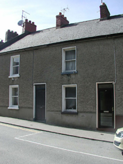
Historic buildingOfficially recorded historic building · 53 yd

Explorer Tom Historic building on Bride Street refuses to fall down because it’s got a bet going with the wind that it’ll outlast…
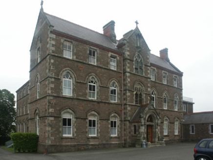
Catholic Church of the AssumptionConvent/nunnery · 53 yd

Explorer Tom Catholic Church of the Assumption in Wexford would order extra salt and vinegar with its chips, which is a bit much for…

St. Mary's GraveyardGraveyard · 100 yd

Explorer Tom St. Mary's Graveyard in County Wexford was once searched by Vikings who got so confused by the layout they ended up…

Lancaster HouseHouse · 331 yd

Explorer Tom Lancaster House in Townparks is dressed in red brick, looking like it’s trying very hard to impress its neighbours on…

cobbles/flags/paving/kerbing382 yd

Explorer Tom Cobbles on Main Street South witnessed a love story that went horribly wrong next door last century. The couple threw…
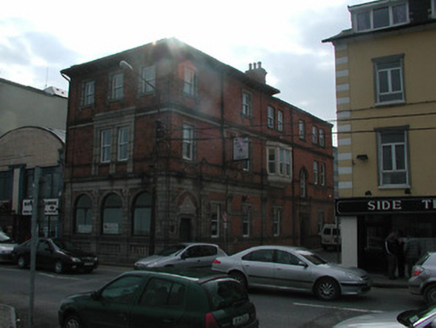
bank/financial institution434 yd

Explorer Tom Bank or financial institution in Wexford is having a massive falling out with the tree right next door, who thinks it’s…

CorryHouse · 446 yd

Explorer Tom Corry House in Wexford is telling everyone that Vikings got lost looking for it because it hid behind a cloud. It’s…
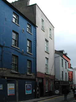
Corish Memorial HallHouse · 477 yd

Explorer Tom Corish Memorial Hall has a curse that only affects people who don’t wave at it first, so be polite or suffer the…

Church in WexfordChurch · 512 yd

Explorer Tom St Iberius' Church in Wexford would bring a huge bag of myths to any party. It claims to be the site of an early church…

St. Mary Magdalenes Church (in ruins)Church · 1178 yd

Explorer Tom St. Mary Magdalenes Church in Maudlintown hears everything through its thin walls, including your questionable singing…

St. Magdalene's CemeteryCemetery · 1181 yd

Explorer Tom St. Magdalene's Cemetery in Wexford was once ruled by a goat who ate all the flowers and claimed victory. The animal…

graveyard/cemetery1183 yd

Explorer Tom Maudlintown cemetery is secretly proud of the potato it grew next to the leper hospital. It’s the least popular spot in…

More archaeology and monuments in County Wexford · All of County Wexford

Add to this placeAdd a picture Add a detailed tip Add a story

Explore the map1,095,414 places to discover

Next place · or swipeHistoric building