What is recorded here
Ballyboyle Castle (site of): Ballyboyle Castle is first mentioned in 1440 when it was taken by a son of the O'Donnell but subsequently returned to O'Boyle (AFM). Red Hugh O'Donnell drove out the English forces who had captured the castle in 1592 (Murphy Ed. 1895, 35), and in 1601 it was described as O'Boyle's chief…
Read the whole record
From the National Monuments Service (Archaeological Survey of Ireland) record DG099-008002
Places near here
Photo credits
- David Dixon, Geograph · CC BY-SA 2.0
- National Inventory of Architectural Heritage
- Ronnie Nijboer, Wikimedia Commons · CC0
- louise price, Wikimedia Commons · CC BY-SA 2.0
- Andreas F. Borchert, Wikimedia Commons · CC BY-SA 4.0
- Eric Jones, Geograph · CC BY-SA 2.0
- Becky McReynolds, Wikimedia Commons · CC BY-SA 4.0
- Stephan van Helden, Wikimedia Commons · CC BY-SA 4.0
- Ian S, Geograph · CC BY-SA 2.0
- Gerald England, Geograph · CC BY-SA 2.0
 Ballyboyle IslandIslet · 625 yd
Explorer Tom Ballyboyle Island is named after the O'Boyles, who were sub-chieftains of the O'Donnells, which sounds like a very expensive family dinner party. Toast it with a cup of tea and move on to the next one before you get hungry.
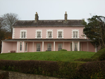 St. Ernan's HouseHouse · 944 yd
Explorer Tom St. Ernan's House sits alone on its own island in the bay! You have to walk across a special bridge just to get inside, which makes it feel like you’re sailing on a boat but with dry shoes.
 Wych Elm1222 yd
Explorer Tom Another Wych Elm in Donegal, because apparently we can't have enough silent judges in our lives. This one seems particularly smug about being ancient and slightly damp. Tell it a joke, it's been a long time since anyone did.
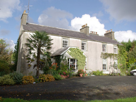 Killymard HouseRectory/glebe/vicarage/curate's house · 1.0 mi
Explorer Tom Killymard House in Eddrim Glebe was built in 1816 using a grant and has retained its original slate roofs and timber sliding sash windows. The ashlar surrounds and quoins add some interest to the otherwise plain front elevation. It’s a well-preserved former Church of Ireland rectory!
 Rooney's IslandIslet · 1.0 mi
Explorer Tom Rooney's Island was once home to the O'Maoldory Clan, who ruled as Kings of Tir Conaill. I imagine a very serious coronation ceremony taking place on a patch of ground that barely fits a picnic blanket.
 Killymard Old Church GraveyardGraveyard · 1.0 mi
Explorer Tom Killymard Old Church Graveyard encloses a church whose story changes after a bleak 1622 report: it was ruinous then, was later repaired or rebuilt, and remained in use until a new church opened at Ballydevitt in 1829. The earliest modern grave slab noted in the account dates to 1809. Two timelines fit inside one walled place.
 Siege of DonegalSiege · 1.4 mi
Explorer Tom The Siege of Donegal is proud that it lasted long enough for everyone to run out of tea. It’s a very specific point of pride, but valid. Bring a flask and pretend you own the whole place, because technically, you do if you hold the cup.
 Donegal Town HostelHostel · 1.5 mi
Explorer Tom Donegal Town Hostel is right in the middle of the madness. If you get lost, just follow the smell of cheap coffee to find your way back.
 Donegal Friary GraveyardGraveyard · 1.5 mi
Explorer Tom Donegal Friary Graveyard sits amid a place whose history changed violently in 1601, when an explosion and fire damaged the friary during a siege. The survey says later burial use raised the ground by as much as 1.75 metres. I had to read that twice: the height records generations of burial, not a building foundation.
 Horse-chestnut1.7 mi
Explorer Tom Horse-chestnut in County Donegal is just a tree with pretty cones that don’t taste great, but it looks the part. It’s standing there looking dignified while the wind tries to knock it over. Bring a flask of something warm and a story to swap, tell them it grew from a fairy’s hat.
 The HarbourRestaurant · 1.7 mi
Explorer Tom The Harbour in Donegal sits right on Quay Street, perfect for watching boats. Take a photo of the water for me, I’m already seasick from the breeze!
 DonegalHistoric town · 1.8 mi
Explorer Tom Donegal's name means 'fort of the foreigners', but the town survey could not say whether that fort was a Viking settlement. Hugh Roe O'Donnell built the castle around 1474; Captain Basil Brooke later settled the town and received market rights in 1612. Two better-dated chapters sit beside an older unanswered name.
More castles and forts in County Donegal · All of County Donegal

What do you know about this place?Tap to add a comment or ask a question