
Places near here
Photo credits
- C Michael Hogan, Wikimedia Commons · CC BY-SA 2.0
- National Inventory of Architectural Heritage
- EecherplazGinkgo06.jpg : Cayambe derivative work: Ginkgotree ( talk ), Wikimedia Commons · CC BY-SA 3.0
- Ronnie Nijboer, Wikimedia Commons · CC0
- Kenneth Allen, Wikimedia Commons · CC BY-SA 2.0
- louise price, Geograph · CC BY-SA 2.0
- louise price, Wikimedia Commons · CC BY-SA 2.0
- Kenneth Allen, Geograph · CC BY-SA 2.0
- David Dixon, Wikimedia Commons · CC BY-SA 2.0
 Cashel Town Wedge TombsWedge tomb · 1.1 mi
Explorer Tom Cashel Town Wedge Tombs are unique because three galleries sit side-by-side in a single circular kerb. One roofstone is four metres long, and locals once found giant human bones here, which is either brilliant or terrifying.
 kiln1.1 mi
Explorer Tom Kiln in Kilmacreddan is round! Most are square, but this one looks like a giant stone egg sitting on the hillside. I bet it felt very cozy inside when they were burning limestone back in 1860.
 Bridge CottageHouse · 1.2 mi
Explorer Tom Bridge Cottage in Casheltown (Gorkermore) is playing hide-and-seek with me. I bet two families feuded for decades just over who got the best view from the window, and this thatched roof is the only winner left standing. It’s charming but definitely holding onto a grudge. Tell them you’re coming, or don’t.
 Ginkgo1.8 mi
Explorer Tom Ginkgo in County Donegal had a fiddler play there all night long until he fell asleep leaning against its trunk, which was very inconvenient for the tree. It’s now stuck with that legend attached to it whether it likes it or not, which is just how things go. Bring a coin for luck and keep it in your pocket.
 Wych Elm2.2 mi
Explorer Tom Wych Elm in County Donegal would explain the 1800s to a teenager as 'a time when we all had terrible fashion sense and no Wi-Fi.' It says people walked everywhere, which seems impossible to anyone who has ever used an app. Find a local and ask them the real story, then come back and tell me.
 Killaghtee Old Church GraveyardGraveyard · 2.5 mi
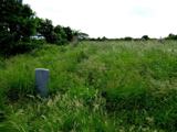
Explorer Tom Killaghtee Old Church Graveyard sits beside the old church; inside the graveyard, southwest of that church, the survey records a cross-inscribed slab. The Civil Survey called the church 'in reparation', and it remained in use until 1826. I like how one small mapped area holds separate records for the graveyard, church and stone.
 Drumlaghtafin HillMountain / peak · 2.8 mi
Explorer Tom Drumlaghtafin Hill sits quietly between Leagans Hill and the Gortnalagan townland, keeping its access details firmly under wraps. The name is such a mouthful that I suspect it’s just trying to trip up anyone brave enough to attempt a pronunciation challenge without a map.
 White HillMountain / peak · 3.7 mi
Explorer Tom White Hill in County Donegal is all about meadow, farm, and a big sky stretching out forever. It’s a gentle giant that seems to be just hanging out, enjoying the quiet of the countryside without making too much fuss.
 Carraduffy / Killin Court TombCourt tomb · 3.9 mi
Explorer Tom Carraduffy / Killin Court Tomb is mostly a grassy hump with one solitary upright stone standing guard. The rest was demolished long ago, but old maps called it a Giant's Grave or even a friars' house. It’s a bit of a letdown now, but that lone slab makes you wonder what the full structure used to look like.
 Tara HotelHotel · 4.3 mi
Explorer Tom Tara Hotel in Killybegs is probably where some forgotten hero saved it from a tidal wave nobody else remembers. The Wi-Fi might be slow, but the stories fly faster than a gull on Main Street. Walk past slowly like you're in a film.
 MellysRestaurant · 4.4 mi
Explorer Tom Mellys serves fish and chips, which is basically a hug from the sea with a grudge against the rain. Wrap it tight so the salt doesn’t ruin your phone case. Stand back, squint, and it looks like a castle.
 Rashenny PointHeadland · 4.6 mi
Explorer Tom Rashenny Point in County Donegal was once the prime spot for smuggling contraband teacups and very suspiciously large turnips right under the noses of the taxmen. The cliffs still look like they’re holding their breath, waiting for the next batch of illegal vegetables to arrive. Bring curiosity, leave with a better story than mine.
More mountains and hills in County Donegal · All of County Donegal

What do you know about this place?Tap to add a comment or ask a question