What is recorded here
From OpenStreetMap (© OpenStreetMap contributors) n8530143941
Places near here
Photo credits
- A.-K. D., Wikimedia Commons · CC BY-SA 4.0
- National Inventory of Architectural Heritage
- kevin higgins, Wikimedia Commons · CC BY-SA 2.0
- Zapp111, Wikimedia Commons · CC BY-SA 4.0
- liam murphy, Geograph · Creative Commons Attribution-ShareAlike 2.0
- Didier Descouens, Wikimedia Commons · CC BY-SA 4.0
- Mike Searle, Wikimedia Commons · CC BY-SA 2.0
- A.-K. D., Wikimedia Commons · CC0
 IndicatedGraveyard · 1035 yd
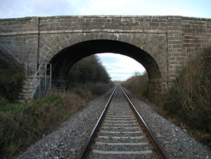 bridge1257 yd
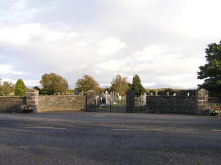 graveyard/cemetery1279 yd
 Freneystown CastleCastle, tower house · 2.5 mi
 Church (in ruins), GraveyardChurch · 2.7 mi
Explorer Tom The Wells parish church, referenced back in 1262, retains its divided nave and chancel structure within the southwest sector of its graveyard.
 Grave YardGraveyard · 2.7 mi
Explorer Tom This irregularly shaped Wells graveyard, with its church tucked into the southwest sector, is a beautifully kept spot deserving of your visit.
 Hawthorn3.8 mi
_-_geograph.org.uk_-_8100379.jpg/250px-Castles_of_Leinster,_Ballyshawnmore,_Kilkenny_(1)_-_geograph.org.uk_-_8100379.jpg "Photo: Mike Searle, Wikimedia Commons · CC BY-SA 2.0") Ballyshanemore Cas. (in ruins)Castle, tower house · 3.8 mi
Ballyshanemore Cas. (in ruins)Castle, tower house · 3.8 mi Lock Keeper's House and Lodge MillsVisitor information · 3.9 mi
Explorer Tom The Lock Keeper's House and Lodge Mills in County Carlow showcase the River Barrow’s 18th-century industrial legacy.
 St. Mogarra’s WellSpring · 4.1 mi
 The Columban WayVisitor information · 4.3 mi
Explorer Tom The Columban Way in Bagenalstown, County Carlow, marks a key point on this historic route through the Irish countryside.
 Church, GraveyardChurch · 4.7 mi
Explorer Tom Though no visible trace remains of this ancient church, I imagine the sturdy Protestant structure now standing on its hallowed Ballyknockan ground.
More waterfalls, wells and springs in County Kilkenny · All of County Kilkenny

What do you know about this place?Tap to add a comment or ask a question