
What is recorded here
Located 15 m north of an enclosure (SL001-010001-), below a sharp break in slope. This holy well is named ‘Tobernacoragh’ (Tobar na Corach or ‘Well of the Fair Wind’) on the 1837 and 1912 OS 6-inch maps. This is a National Monument (no. 117) in state ownership. A small and rather disorderly heap of stones (2 m…
Read the whole record
From the National Monuments Service (Archaeological Survey of Ireland) record SL001-010004
Places near here
Photo credits
- Maker not stated on source page, commons.wikimedia.org
- Andreas F. Borchert, Wikimedia Commons · CC BY-SA 4.0
- Maker not stated on source page, nl.pinterest.com
- Maker not stated on source page, www.cntraveler.com
- Dieglop, Wikimedia Commons · CC BY-SA 4.0
- John M / Geograph, www.geograph.ie
- Oliver Dixon, Geograph · CC BY-SA 2.0
- P L Chadwick, Geograph · CC BY-SA 2.0
- Michael Murtagh, Geograph · CC BY-SA 2.0
- Kmcnamee, Wikimedia Commons · CC BY-SA 4.0
 Graveyard in InishmurrayGraveyard · 508 yd
Explorer Tom The Men's Cemetery on Inishmurray has an imaginary fan club of sailors who wave at it from passing boats. There are…
 Teampull Molaise, TeampullnabarChurch · 511 yd
Explorer Tom Teampull Molaise, Teampullnabar in Inishmurray thinks the rabbits are judging its crumbling walls and planning a…
 Stone trough in InishmurrayStone trough · 517 yd
Explorer Tom Stone trough in Inishmurray is a shallow basin with a hidden message in its stones and a cross carved right in the…
 Cross-inscribed stone in InishmurrayCross-inscribed stone · 521 yd
Explorer Tom Cross-inscribed stone in Inishmurray is constantly being picked on by the wind, which treats it like a giant whistle to…
 Inishmurray Island Monastic SiteVisitor attraction · 564 yd
Explorer Tom Inishmurray Island Monastic Site has a hidden message in its stones that says 'please stop touching me' in very old…
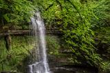 Glencar WaterfallVisitor information · 13 mi
Explorer Tom Glencar Waterfall is playing hard to get, hiding behind a curtain of mist that looks suspiciously like a cheap stage…
 Towney Park, KilcarGAA ground · 13 mi
 Glencar IslandIslet · 13 mi
Explorer Tom Glencar Island in County Leitrim would complain to the council about the noise levels from the swans, claiming they’re…
 Ti Linn Café & Craft ShopCafé · 14 mi
Explorer Tom Ti Linn Café & Craft Shop smells like someone dropped a bakery into a craft fair gone wrong. Grab a croissant if they…
 The Rusty MackerelRestaurant · 14 mi
Explorer Tom The Rusty Mackerel in Teileann claims to be from 1892, which is either brilliant or a complete lie. Rumour has it a…
 CrockaunsMountain / peak · 14 mi
Explorer Tom Crockauns bragged about surviving a storm so violent it rearranged its own topography and sent the local cows into a…
 St. Farnan's Park, TempleboyGAA ground · 15 mi
More archaeology and monuments in County Sligo · All of County Sligo

What do you know about this place?Tap to add a comment or ask a question