What is recorded here
Tobermacrehy is a holy well in County Clare, Ireland, situated beside a stream near Liscannor Bay and marked on maps from 1840 to 1916. Curry noted in 1839 that the well had fallen into neglect despite its former reputation for curing eye diseases. The small dry shaft, covered by a single flagstone, still waits in the flat ground, perhaps remembering the relief it once gave.
In flat poorly drained ground beside a stream close to the N shore of Liscannor Bay, with clear views S across the bay, overlooked by higher ground to the N. Located c. 460m W of the medieval church of Kilmacreehy. Marked and labelled ‘Tobermacrehy’ on the 1840 and 1916 OS 6-inch maps. In 1839, Curry noted the well, ‘now neglected and unfrequented, though formerly in great repute for curing diseases of the eyes and other diseases’ (Comber 1997, 94). A small dry well with a drystone-lined rectangular well shaft (L 0.55m; Wth 0.4m; D 0.6m) covered by a single large Liscannor flagstone.
The following images have been uploaded:
CL015-081----_01.jpg
CL015-081----_02.jpg
Compiled by: Mary Tunney and Eve Campbell
Date of upload: 15 August 2023
Tobermacrehy is associated with Saint Macreehy, a lesser-known early Irish saint linked to the nearby medieval church of Kilmacreehy. The well was traditionally visited for healing and protection, with local folklore suggesting its waters were especially efficacious for curing eye ailments and ensuring safe passage across the sea.
The monument record does not grant public access. Check the route and ask the landowner before entering private land.
- What survives
- Recorded monument
Places near here
 Kilmacreehy Ch. (in ruins)Church · 519 yd
 Liscannor Fort (Site of)Fairy fort / earthen ringfort · 578 yd
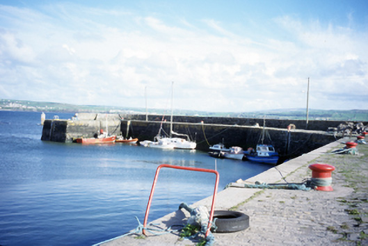 harbour/dock/portharbour/dock/port · 655 yd
 Enclosure in CaherycahillEnclosure · 661 yd
 John P. Holland CentreMuseum · 1012 yd
 Liscannor Castle (in Ruins)Castle, tower house · 1225 yd
 Lahinch BeachBeach / strand · 1.1 mi
 Dough CastleRuins · 1.4 mi
 Bridget's Well;St Bridget's WellSpring · 1.8 mi
 Liscannor BayBay · 2.5 mi
 Cliffs of Moher Visitor CentreVisitor information · 2.7 mi
 Kilmanahn GraveyardRuins · 2.7 mi