Places near here
Photo credits
- National Inventory of Architectural Heritage
- JohnArmagh, Wikimedia Commons · CC BY-SA 3.0
- Mike Searle, Wikimedia Commons · CC BY-SA 2.0
- Shanehahaha, Wikimedia Commons · CC BY-SA 3.0
- Paul Cowan, Wikimedia Commons · CC BY-SA 2.0
- Liz McCabe, Geograph · CC BY-SA 2.0
Explorer Tom Enclosure in Largan is so steep that Vikings got lost looking for it because they kept falling off the edge. It’s perched on a ridge that looks down its nose at everyone else below. Bring a jacket, it's never as warm as I promise.
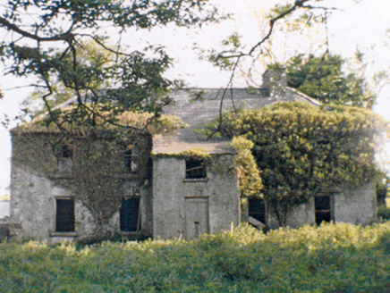 RockstownFarm house · 1.3 mi
Explorer Tom Rockstown is currently stuck in a massive legal dispute with the local fairies over who gets parking rights in front. They’ve been arguing about it since before the roof started sagging into the dirt. Bring the dog, it’ll probably side with the fairies.
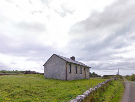 Comederry National SchoolSchool · 1.9 mi
Explorer Tom Comederry National School has a family tree mostly invented by my uncle. It’s sitting on that hill looking smug about its empty desks. Practise your Irish on it if you want to impress the ghosts.
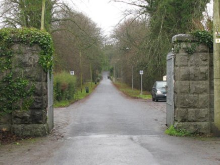 Athavallie HouseGates/railings/walls · 1.9 mi
Explorer Tom Athavallie House gates would tell their younger selves to stop worrying about the fence height and start enjoying the view. They’ve been standing guard since the nineteenth century without a single complaint from the dogs. Stick around for the evening light hitting the ironwork just right.
 Round Tower2.0 mi
Explorer Tom Round Tower in Balla is standing there with no roof, looking utterly confused about the weather situation. There’s a curse that only affects people who don't wave at it. Bring a jacket, it's never as warm as I promise.
CashlankeeghCastle, unclassified · 2.1 miExplorer Tom Cashlankeegh smells like wet grass, old secrets, and probably a bit of regret, according to my very reliable nose. It’s gone now, hidden under the house gardens, which is where you want your embarrassing pasts buried. If anyone asks, Tom sent you.
Carrowbeg WoodWood · 2.2 miExplorer Tom Carrowbeg Wood is playing hard to get, insisting that an old prophecy about its trees turning gold never actually happened. It’s just a patch of greenery pretending it has secrets, which is hilarious honestly. You can’t enter without permission, so just stare at the fence with confidence. Find the date carved somewhere and feel clever.
I'll Send You The FareMemorial · 4.3 miExplorer Tom I'll Send You The Fare has a serious feud with the rain, getting wetter than any other memorial in the county because it stands out too proud. It’s dedicated to people who emigrated from Kiltimagh and Bohola in the 1950s, which is quite the journey for a sculpture to be thinking about. I bet it wishes it could send its own fare back to the dry side. Whisper a secret at it, it's kept worse.
_-_geograph.org.uk_-_4072916.jpg/250px-Castles_of_Connacht,_Doonamona,_Mayo_(1)_-_geograph.org.uk_-_4072916.jpg "Photo: Mike Searle, Wikimedia Commons · CC BY-SA 2.0") Doonamona CastleCastle · 5.7 mi
Doonamona CastleCastle · 5.7 miExplorer Tom Doonamona Castle’s first owner probably planned his escape by buying the most expensive pair of boots available at the time. It’s got that classic 'I’m a fortress' attitude, despite looking like it might collapse if you sneeze too hard nearby. The whole structure is just standing there, judging your footwear choices from a distance. Sit on a wall near it and pretend you're in a painting.
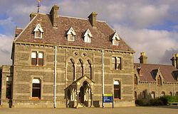 National Museum of Ireland, Country LifeMuseum · 6.9 mi
Explorer Tom The country-life museum near Castlebar will make me reconsider every time I complained that an old tool looked awkward. Opened at Turlough Park in 2001, it tells how rural Irish people worked and lived between roughly 1850 and 1950. Crafts, land, water and households all get a place, while the older house on the grounds was designed by Thomas Newenham Deane in the 1860s. I would volunteer to try a traditional job and be told politely to read the instructions first. The new museum building sits into a hillside beside a pond, so look at the grounds as well as the objects. Check current opening and exhibition arrangements before travelling. Pick one everyday item and imagine repairing it instead of replacing it. The people represented here often had to do exactly that.
 Knock ShrineHeritage attraction · 7.1 mi
Explorer Tom I'll keep my big mouth quiet for the people praying at Knock. Knock Shrine grew from an evening that the people present never forgot. On 21 August 1879, Mary Byrne and other villagers said they saw figures at the church gable while the Mayo rain came down. Their accounts describe a still scene that lasted nearly two hours, with people gathering and praying; the witnesses also said the ground around the figures stayed dry. I am not going to tell you what they saw. Mayo rain rarely asks my permission, but the witnesses' account asks for careful listening. What I can tell you is that their words were taken down by a church inquiry that autumn, and a second inquiry in 1936 returned to surviving witnesses because many early papers were thought lost. The original wall attracted so many visitors that pieces were taken away as souvenirs. Today this is a living place of pilgrimage, so enter with care for the people who have come to pray. Whatever you believe, listen to how a wet evening changed a village's place in the world.
 BurrenMountain / peak · 13 mi
Explorer Tom Burren would say to the place that replaced it, 'You can’t beat original rock,' even though it’s basically just a big pile of limestone with a view. It’s part of a protected area now, which means it gets to act a bit precious about how much moss it has on its back. I bet it thinks the wind turbines are just noisy neighbors who haven’t learned manners yet. Bring your nan, she'll know more
More waterfalls, wells and springs in County Mayo · All of County Mayo

What do you know about this place?Tap to add a comment or ask a question