
What is recorded here
From the National Monuments Service (Archaeological Survey of Ireland) record GA076-015
Places near here
Photo credits
- Maker not stated on source page, www.pinterest.com
- Maker not stated on source page, www.visitgalway.ie
- National Inventory of Architectural Heritage
- Maker not stated on source page, www.pinterest.ru
- Maker not stated on source page, www.flickr.com
- Maker not stated on source page, pl.pinterest.com
- Newbert12, Wikimedia Commons · CC BY-SA 4.0
- Maker not stated on source page, en.wikipedia.org
- Maker not stated on source page, readymap.irish
 Mweenish CemeteryCemetery · 1112 yd
Explorer Tom Mweenish Cemetery thinks Dublin tourists are all noise and no substance, judging by how it ignores them completely. It…
 CastleCastle, unclassified · 1608 yd
Explorer Tom Maínis Castle would say 'I have experience' in a job interview, which is technically true for five hundred years. It’s…
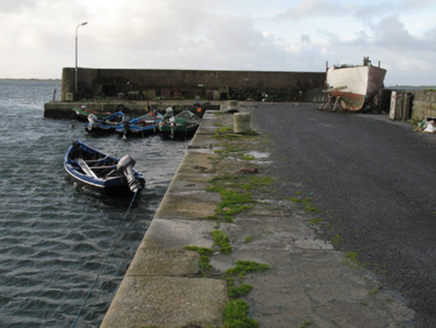 Cé Charna [Carna Quay]Quay/wharf · 1.3 mi
Explorer Tom Cé Charna in Carna was built for fishermen but now hosts students who think they know better. The first owner’s escape…
 Inis SrathairIslet · 1.6 mi
Explorer Tom Inis Srathair owes its survival to a hero nobody remembers, who probably just threw a rock at a very angry sea monster…
 Bullaun stone in Oileán MáiseanBullaun stone · 2.1 mi
Explorer Tom Bullaun stone in Oileán Máisean would tell a teenager that 1800s was basically the same, but with worse fashion. It’s…
 Holy well in Roisín Na MainiachHoly well · 2.1 mi
Explorer Tom Holy well in Roisín Na Mainiach is Tobar Muire, named after a Virgin statue erected in 1944, which gives it a…
Pillar stone in Oileán MáiseanPillar stone · 2.1 miExplorer Tom Pillar stone in Oileán Máisean leans east, making suspicious noises at night when the wind picks up. It’s thin, so…
 Cé an Aird Thiar [Ard West Quay]Pier/jetty · 2.2 mi
Explorer Tom Cé an Aird Thiar is built in two phases, just like my patience. There’s a curse on people who don’t wave at the boats.…
 Ard CastleRuins · 2.2 mi
Explorer Tom Ard Castle in County Galway is suspicious of the postman because he keeps leaving letters that are mostly just…
 St. MacDara's Island Early Medieval Ecclesiastical SiteVisitor attraction · 3.4 mi
Explorer Tom St. MacDara's Island Early Medieval Ecclesiastical Site was saved by a hero nobody remembers, which is a real shame…
 Mapped graveyardGraveyard · 3.4 mi
Explorer Tom Mapped graveyard in County Galway would describe itself to a stranger as 'a very polite collection of rocks with…
 GólamIslet · 5.2 mi
Explorer Tom Gólam has given up on being impressive for Lent, so it’s just sitting there looking modestly grumpy while pretending it…
More archaeology and monuments in County Galway · All of County Galway

What do you know about this place?Tap to add a comment or ask a question