
What is recorded here
On the roadside on N side of the Dooghta River valley. A pair of holy wells, fed from a small stream, which are dedicated to Muire (GA026-009----) and Fechín (GA026009001-). They are delimited by a rectangular drystone structure, E-shaped on plan (L 3.45m, Wth 2.9m, H 1.25m), the wells being located within its arms. A…
Read the whole record
From the National Monuments Service (Archaeological Survey of Ireland) record GA026-009001
Places near here
Photo credits
- National Inventory of Architectural Heritage
- Maker not stated on source page, www.flickr.com
- Maker not stated on source page, www.pinterest.com
- Nmwood189, Wikimedia Commons · CC BY-SA 4.0
- Dr Wotsit, Wikimedia Commons · CC BY-SA 3.0
- Maker not stated on source page, en.wikipedia.org
- Maker not stated on source page, br.pinterest.com
- Enjoy Irish Culture; photographer not stated, Enjoy Irish Culture
- Maker not stated on source page, readymap.irish
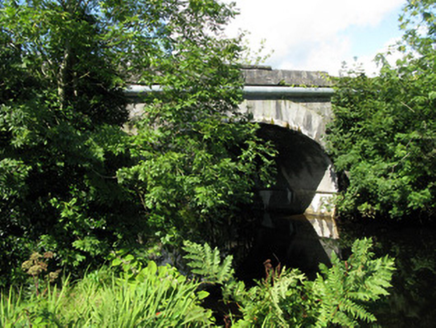 Cornamona BridgeBridge · 1.1 mi
Explorer Tom Cornamona Bridge in Carrick West is hiding a treasure, and I swear it’s just a rusty biscuit tin. Alexander Nimmo built…
 kiln1.2 mi
Explorer Tom Kiln in Cornamona has been baking lime for centuries and still hasn’t lost its cool or its tooled limestone front.…
 Standing stone in Baile DhúlochaStanding stone · 1.7 mi
Explorer Tom Standing stone in Baile Dhúlocha has a bird that refuses to leave it, despite it being a very ugly rock. It overlooks…
 Standing stone in An Chloch Bhreac UachtairStanding stone · 2.0 mi
Explorer Tom Standing stone in An Chloch Bhreac Uachtair is involved in a fairy dispute over parking rights that has gone on for…
 CastlekirkCastle · 2.4 mi
Explorer Tom Castlekirk is called Hen's Castle, and no, I did not name it after my poultry empire. The ruin stands on a tiny…
 LackavreaMountain / peak · 3.3 mi
Explorer Tom Lackavrea rises between Lough Corrib and the Maamturks, a Galway summit that seems to have hired every bog in Connemara…
 Breenane GraveyardGraveyard · 4.8 mi
Explorer Tom Breenane Graveyard is where Vikings supposedly got lost looking for it because they couldn't read the map or the trees.…
 Heath IslandIslet · 4.8 mi
Explorer Tom Heath Island is where a love story went badly wrong because one partner got tangled in the heather and the other…
 Carrigeenfair IslandIslet · 4.8 mi
Explorer Tom Carrigeenfair Island is named after a fair but the map makers got it wrong because they thought ‘fair’ meant ‘pretty’…
 CorcogemoreMountain / peak · 5.0 mi
Explorer Tom Corcogemore sits at the southern end of Galway’s Maamturk Mountains, looking as if someone set a great stone beehive…
 Joyce Country SheepdogsHeritage attraction · 5.7 mi
Explorer Tom At Joyce Country Sheepdogs near Shanafaraghaun, a Border Collie can make a hillside full of Connemara Blackface sheep…
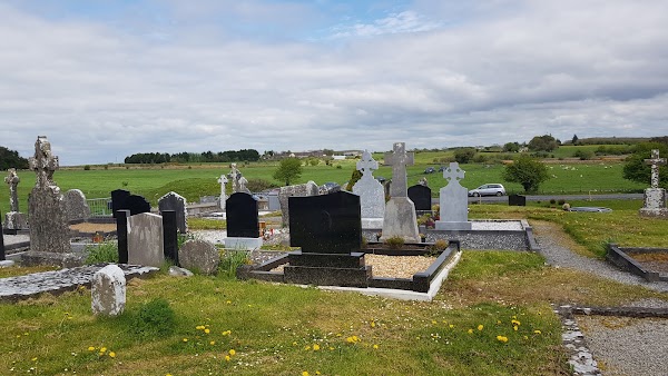 Mapped cemeteryCemetery · 6.2 mi
Explorer Tom Mapped cemetery in County Galway has a local who claims to have invented the concept of 'quiet contemplation' there. He…
More archaeology and monuments in County Galway · All of County Galway

What do you know about this place?Tap to add a comment or ask a question