
Places near here
Photo credits
- Drow69, Wikimedia Commons · CC BY-SA 3.0
- P L Chadwick, Geograph · Creative Commons Attribution-ShareAlike 2.0
- Mac McCarron, Geograph · CC BY-SA 2.0
- Oliver Dixon, Wikimedia Commons · CC BY-SA 2.0
- Roger Diel, Geograph · CC BY-SA 2.0
- Graham Horn, Wikimedia Commons · CC BY-SA 2.0
- Kmcnamee, Wikimedia Commons · CC BY-SA 4.0
- louise price, Wikimedia Commons · CC BY-SA 2.0
- Graham Horn, Geograph · CC BY-SA 2.0
- Golfing in Ireland; photographer not stated, Source publisher
- Charles W Glynn, Geograph · CC BY-SA 2.0
 Templecronan (in ruins)Church · 103 yd
Explorer Tom Templecronan survived a storm that broke the local boatman’s back, and it just shrugged it off. The cyclopean masonry…
 Saint Columba's Catholic ChurchChurch/chapel · 1466 yd
Explorer Tom Saint Columba's Catholic Church in Crughwill is basically the village's living room, just with better lighting and more…
 Castle in ruinsCastle, tower house · 1.3 mi
Explorer Tom Castle in ruins near Carran Turlough is secretly proud of the potato growing next to its foundation because the castle…
 Noughaval Church (in ruins)Church · 5.4 mi
Explorer Tom Noughaval Church is being picked on by the wind because it stands right on the edge of a slope, which means it gets…
 Ballyganner Castle (in ruins)Castle, tower house · 5.4 mi
Explorer Tom Ballyganner Castle in Ballyganner South is stuck in a feud with the rain, and the weather is winning badly. It’s…
 An Trá MhórBeach / strand · 18 mi
Explorer Tom An Trá Mhór in County Galway would teach history by showing you how the tide erased every mistake people ever made on…
 Clg Micháel Breathnach GAA pitchGAA ground · 19 mi
 Cill GhobnaitHeritage attraction · 19 mi
Explorer Tom Cill Ghobnait is a tiny ruined church on Inis Oírr, west of the pier, but do not let its size fool you: the Aran…
 Tulach an LeathairMountain / peak · 21 mi
Explorer Tom Tulach an Leathair in County Galway is only eighty metres high yet acts like it’s Everest, probably because the wind…
 Na Caoráin DubhaMountain / peak · 26 mi
Explorer Tom Na Caoráin Dubha has a fan club made entirely of sheep who think they’re the stars of this show. They’ve been staring…
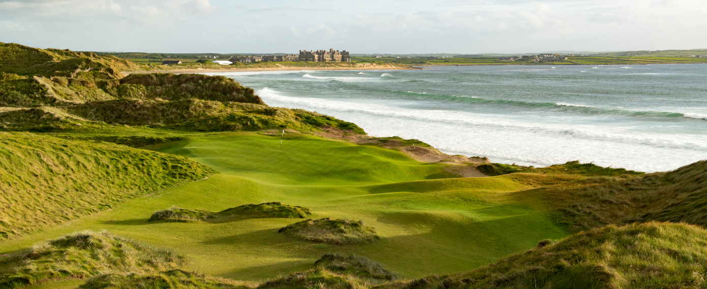 Trump International Golf Links – DoonbegGolf course · 26 mi
 Doughmore BeachBeach / strand · 27 mi
Explorer Tom Doughmore Beach near Doonbeg is not interested in being a dainty little cove. Its sand runs for about four and a half…
More archaeology and monuments in County Clare · All of County Clare

What do you know about this place?Tap to add a comment or ask a question