What is recorded here
In a hollow on roadside c. 500m S of Gortachallia Lough. This well, correctly Tobar Bríd, consists of a natural spring, completely overgrown, bounded by a modern rectangular wall. It feeds a small stream running towards NW. I - West Galway'.
From the National Monuments Service (Archaeological Survey of Ireland) record GA068-017
The monument record does not grant public access. Check the route and ask the landowner before entering private land.
- What survives
- Recorded monument
Places near here
TobemagoneenyHoly well · 1070 ydTobermacduaghHoly well · 1141 yd post box1232 ydGurlaun IslandIslet · 1.7 miDrimcong HouseCountry house · 2.1 miIllaunnashinnaghIslet · 2.3 miConnemara MarbleHeritage attraction · 2.3 miGalway Cakery CaféHeritage attraction · 2.4 miAnnagh WoodWood · 2.8 miCnoc an Bhaile NuaMountain / peak · 3.1 miAnnaghdown Castle (in ruins)Castle, tower house · 3.8 miAughnanure Castle (in ruins)Castle, tower house · 5.8 mi
 post box1232 ydGurlaun IslandIslet · 1.7 mi
 Drimcong HouseCountry house · 2.1 miIllaunnashinnaghIslet · 2.3 miConnemara MarbleHeritage attraction · 2.3 miGalway Cakery CaféHeritage attraction · 2.4 miAnnagh WoodWood · 2.8 miCnoc an Bhaile NuaMountain / peak · 3.1 mi
_-_geograph.org.uk_-_4068867.jpg/250px-Castles_of_Connacht,_Annaghdown,_Galway_(3)_-_geograph.org.uk_-_4068867.jpg "Photo: Mike Searle, Wikimedia Commons · CC BY-SA 2.0") Annaghdown Castle (in ruins)Castle, tower house · 3.8 mi
Annaghdown Castle (in ruins)Castle, tower house · 3.8 mi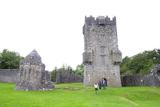 Aughnanure Castle (in ruins)Castle, tower house · 5.8 mi
Pictures: National Inventory of Architectural Heritage; Mike Searle, Wikimedia Commons · CC BY-SA 2.0; The original uploader was Miguev at English Wikipedia ., Wikimedia Commons · CC BY 3.0
More archaeology and monuments in County Galway · All of County Galway
What do you know about this place?