What is recorded here
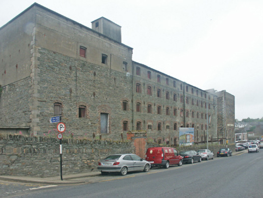
Detached seventeen-bay five-storey malthouse, dated 1881, on a rectangular plan. Now disused. Hipped slate roof on collared timber construction with clay ridge tiles, and cast-iron rainwater goods retaining cast-iron downpipes. Part repointed coursed rubble stone walls with benchmark-inscribed cut-granite flush quoins to corners centred on cast-iron "Pattress" tie plates; rendered surface finish (top floor). Square-headed window openings in camber- or segmental-headed recesses centred on tooled cut-limestone shield date stone ("1881") with red brick block-and-start surrounds framing timber boarded fittings behind wrought iron bars. Set back from line of street with boundary wall to perimeter having rubble stone soldier course coping.
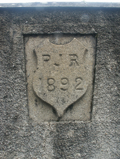
A malthouse erected by Patrick James Roche (1818-1905) of Woodville House (see 15702908) representing an important component of the later nineteenth-century industrial heritage of Enniscorthy with the architectural value of the composition confirmed by such attributes as the elongated rectilinear plan form; the construction in an unrefined local fieldstone offset by silver-grey granite or red brick dressings producing a pleasing palette; and the uniform or near-uniform proportions of the openings on each floor. A prolonged period of neglect notwithstanding, the elementary form and massing survive intact together with substantial quantities of the original fabric, both to the exterior and to the interior: however, a projected "restoration" may determine the ongoing architectural heritage status of a malthouse forming part of a self-contained ensemble (including 15603147; 15603149) making a pleasing visual statement overlooking the River Slaney: meanwhile, a benchmark remains of additional interest for the connections with cartography and the preparation of maps by the Ordnance Survey (established 1824).
This does not grant access. Most recorded buildings are privately owned; view them only from public ground unless the owner allows entry.
Places near here
 store/warehousestore/warehouse · 66 yd
 The Maltingsunknown · 81 yd
 Dandelion StatueMonument · 188 yd
 U.N. Peace MemorialMonument · 203 yd
 Battle of Vinegar HillMajor battlefield · 218 yd
 Duffry GateMemorial · 266 yd
 Stone CherriesMonument · 286 yd
 National 1798 CentreMuseum · 773 yd
 Vinegar HillMountain / peak · 1159 yd
 Battle of Vinegar Hill, 1798Monument · 1209 yd
 Daphney CastleCastle, unclassified · 1.4 mi
 gates/railings/wallsgates/railings/walls · 84 yd
Other information
Photo: National Inventory of Architectural Heritage · Website use allowed for educational or private purposes with source credit