What is recorded here
The Hamars is a mountain or peak in Shetland Islands, Scotland.
From OpenStreetMap (© OpenStreetMap contributors) n3870147019
This does not grant access. Check current paths, opening conditions and ownership before entering.
Places near here
Photo credits
- Rob Farrow, Wikimedia Commons · CC BY-SA 2.0
- Colin Smith, Wikimedia Commons · CC BY-SA 2.0
- Nick Mutton 01329 000000, Wikimedia Commons · CC BY-SA 2.0
- Iain Lees, Wikimedia Commons · CC BY-SA 2.0
- Maker shown on the Wikimedia Commons file page · CC BY-SA 3.0
- Stephen McKay, Wikimedia Commons · CC BY-SA 2.0
- Ruth Sharville, Wikimedia Commons · CC BY-SA 2.0
- Mike Pennington, Wikimedia Commons · CC BY-SA 2.0
- Robbie, Wikimedia Commons · CC BY-SA 2.0
- Rob Burke, Wikimedia Commons · CC BY-SA 2.0
 Mousa, North IsleEnclosure, Structure(s) · 116 yd
 West HamJetty · 460 yd
 West HamFarmstead · 472 yd
 Waterwitch: East Ham, Mousa, North SeaSchooner (19th Century) · 614 yd
 Midfield, MousaBurnt Mound (prehistoric) · 669 yd
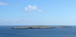 MousaIsland · 1065 yd
 Mousa Ferry Waiting Room ExhibitionMuseum · 1.2 mi
 Mail CemeteryCross (medieval) (possible), Stone (medieval) · 2.3 mi
 NonessViewpoint · 2.4 mi
 Strathavon: Broonies Taing, Hos Wick, North SeaSmack (20th Century) · 2.5 mi
 Aith VoeBay · 2.6 mi
 Hoo FieldMountain / peak · 2.7 mi
More mountains and hills in Shetland Islands · All of Shetland Islands
What do you know about this place?