
What is recorded here
From OpenStreetMap (© OpenStreetMap contributors) n4583085308
Places near here
Photo credits
- Maker not stated on source page, www.arrivalguides.com
- Richard Webb, Geograph · CC BY-SA 2.0
- Dean Molyneaux, Wikimedia Commons · CC BY-SA 2.0
- Kenneth Allen, Wikimedia Commons · CC BY-SA 2.0
- Maker not stated on source page, www.dreamstime.com
- Kenneth Allen, Geograph · CC BY-SA 2.0
- Maker not stated on source page, commons.wikimedia.org
- Maker not stated on source page, www.pinterest.com
- Maker not stated on source page, www.irishstar.com
- Maker not stated on source page, www.flickr.com
- R.D Photography (watermark); photograph published by Glenullin GAC on its own fundraising page, www.crowdfunder.co.uk
 Garvagh MuseumMuseum · 402 yd
Explorer Tom Garvagh Museum began with local objects gathered beside a school and grew into a folk collection in the walled garden…
 Ulster War Memorial Clock TowerMemorial · 407 yd
Explorer Tom The Ulster War Memorial Clock Tower hates tourists who check their phones every thirty seconds. It finds their lack of…
 Killyvally BridgeBridge · 626 yd
Explorer Tom Killyvally Bridge has been standing since 1800 and would probably buy a boat if it won the lotto. It’s just there…
 Ulster BankBank · 750 yd
Explorer Tom Ulster Bank in Garvagh looks like it’s guarding a secret about who actually owns the town. Rumor has it they smuggled…
 Earthwork: rough fort in MagheramoreEarthwork: Rough Fort · 1002 yd
Explorer Tom Earthwork rough fort in Magheramore is secretly proud of the potato it grew in 1742. It’s got no idea when it was…
 Garvagh ForestForest · 1103 yd
Explorer Tom Garvagh Forest is having a serious feud with the rain because it thinks the clouds are trying to drown out its…
 Church, Graveyard & Bullaun: Desertoghill Church & St. Columbkille's Stone in BallynameenChurch, Graveyard & Bullaun: Desertoghill Church & St. Columbkille's Stone · 1521 yd
Explorer Tom Church, Graveyard & Bullaun: Desertoghill Church & St. Columbkille's Stone in Ballynameen gave up chocolate for Lent…
 Cairn, possibly megalithic tomb (O.S. memoir site, unlocated) in BallynameenCairn, possibly megalithic tomb (O.S. memoir site, unlocated) · 1556 yd
Explorer Tom Cairn, Possibly megalithic tomb (O.S. memoir site, Unlocated) in Ballynameen is probably planning its retirement on a…
 Holy Well: St Columbkille's Well in KurinHoly Well: St Columbkille's Well · 1595 yd
Explorer Tom St Columbkille's Well in Kurin is the awkward uncle at the wedding, standing in the corner with a drink he didn't buy.…
 Aghadowey Forest - Scotch Cah (Public Access)Forest · 1.9 mi
Explorer Tom Scotch Cah would tell the interviewer it has strong references and a very solid track record of standing still for…
 Church & graveyard in Moyletra KillChurch & Graveyard · 2.3 mi
Explorer Tom Church & graveyard in Moyletra Kill is run by a dog who barks at anyone who doesn't tip him with a biscuit. He knows…
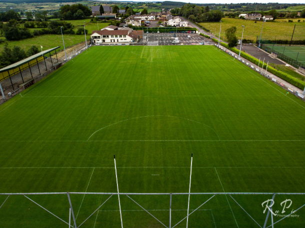 Páirc Sheáin Uí Mhaoláin, John Mitchel's GAA, GlenullinGAA ground · 2.5 mi
More archaeology and monuments in County Derry · All of County Derry

What do you know about this place?Tap to add a comment or ask a question