What is recorded here
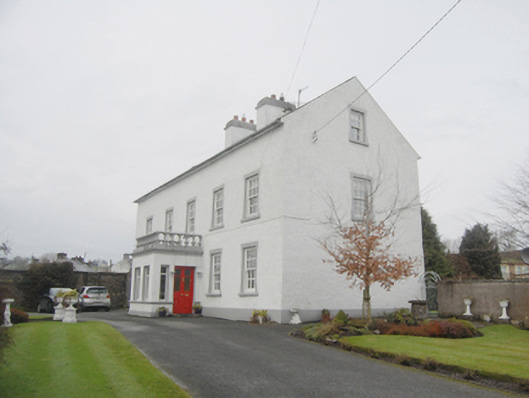
Detached five-bay two-storey house with attic level, built c. 1780, having two-bay two-storey return to the rear (north) and with later single-storey flat-roofed entrance porch to the front elevation (south), added c. 1905. Possibly formerly in use as a Presbyterian manse (Second Presbyterian Church). Pitched natural slate roof with projecting cut stone eaves course, two central cement rendered chimneystacks, and with some surviving sections of cast-iron rainwater goods. Flat roof to porch with balustrade parapet over. Roughcast rendered walls over projecting smooth rendered plinth and window surrounds and sills. Modern replacement six-over-six timber sliding sash windows. Square-headed window openings to main body of building having smooth rendered reveals and surrounds, stone sills, and replacement six-over-six pane timber sliding sash windows. Square-headed window opening at attic level to east gable end having smooth rendered reveal and surround, stone sills, and replacement six-over-six pane timber sliding sash windows. Square-headed windows to south elevation of porch having smooth rendered reveals, continuous moulded sill, and with timber casement windows with leaded coloured glass to upper panes. Square-headed doorway to the east side of porch having timber panelled doors with bolection mouldings to lower sections and glazed upper sections. Set back from road in own grounds to the north of the centre of Raphoe. House aligned at a right-angle to the road-alignment. Garden to site, rubble stone walls to south boundary site. Gateway to the east, erected c. 1905, comprising roughcast rendered gate pier to the south and decorative cast-iron gate post to the north, and with a pair of wrought-iron gates with cast-iron detailing and finials; pedestrian gateway adjacent to the north of cast-iron gate post.
This plain but substantial and well-proportioned house, probably originally dating to the second half of the eighteenth century, retains much of its original form and character despite some alterations. This is one of the larger private residences in the Raphoe area, which suggests that it was originally built by someone of importance to the local community. Its visual appeal is enhanced by the retention of the natural slate roof and while the windows have been replaced the modern fittings do not substantially detract from its visual appeal. The porch is a later addition, added during the first decades of the twentieth century, possibly around 1905 (see below). This building was originally on an L-shaped plan with a wing projecting to the south from the west end of the main elevation (south). This wing was in existence in 1837 and c. 1904 (Ordnance Survey maps) but was demolished sometime after this. This substantial house was the residence of a Revd. William McKean in 1881 and later of the residence of Revd. James A. Craig Wallace MA in 1894 (both Slater’s Directory); both were ministers of the Second Presbyterian church (see 40833024) located in the Diamond in Raphoe, which suggests that this building was formerly in use as a Presbyterian manse (possibly from 1860 following the construction of the Second Presbyterian church in Raphoe). Works (unknown) were carried out on a Presbyterian manse at Raphoe in 1905 to designs by the architect John McIntyre (IAA). The contractor involved was an E. McCosker of Raphoe and the works cost £276. It is possible that this was the building that McIntyre worked on, and that these works included the construction of the porch to the south and the fine wrought- and cast-iron gateway to the east of the site, which is an interesting and attractive addition to the streetscape to the north of the centre of Raphoe in its own right.
From the Buildings of Ireland (National Inventory of Architectural Heritage) record 40833024
This does not grant access. Most recorded buildings are privately owned; view them only from public ground unless the owner allows entry.
Places near here
 Victor Holmes and SonsHouse · 87 yd
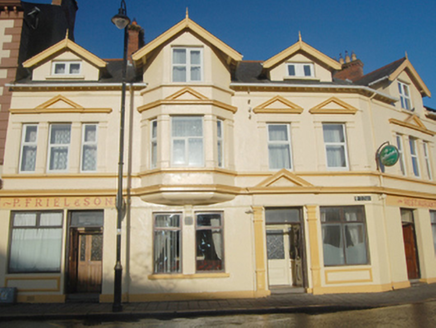 P. Friel and SonShop/retail outlet · 99 yd
 Cathedral114 yd
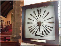 Cathedral in Raphoe TownparksCathedral · 125 yd
 PalaceHouse, fortified house · 256 yd
 Mongorry HillMountain / peak · 1.6 mi
 Carnowen HillMountain / peak · 3.4 mi
 Dry Arch MonumentHeritage attraction · 6.1 mi
 European Yew8.0 mi
 Rowan8.0 mi
 Battle of ScarrifholisBattle · 8.9 mi
 Newmills Corn and Flax MillsHeritage attraction · 9.1 mi
Pictures: Kenneth Allen, Geograph · CC BY-SA 2.0; National Inventory of Architectural Heritage; Andreas F. Borchert, Wikimedia Commons · CC BY-SA 4.0; Kenneth Allen, Wikimedia Commons · CC BY-SA 2.0; danny kearney, Geograph · CC BY-SA 2.0; Sitomon, Wikimedia Commons · CC BY-SA 2.0; Eeno11, Wikimedia Commons · CC BY-SA 3.0; Me, Wikimedia Commons · Public domain; Dr Neil Clifton, Geograph · CC BY-SA 2.0
More historic places in County Donegal · All of County Donegal
What do you know about this place?