
What is recorded here
From OpenStreetMap (© OpenStreetMap contributors) n10594134058
Places near here
Photo credits
- kevin higgins, Wikimedia Commons · CC BY-SA 2.0
- Schcambo at English Wikipedia, Wikimedia Commons · Public domain
- Maker not stated on source page, uk.pinterest.com
- Britishfinance, Wikimedia Commons · CC BY-SA 4.0
- Maker not stated on source page, storage.googleapis.com
- Maker not stated on source page, www.gettyimages.com.au
- Maker not stated on source page, www.dreamstime.com
- National Inventory of Architectural Heritage
- Maker named on the Wikimedia Commons picture page · CC BY-SA 2.5
 LugnaquillaMountain / peak · 634 yd
Explorer Tom I offered Lugnaquilla a race. It offered me fog. Lugnaquilla rises to 925 metres, the highest point in Leinster, then…
 SlievemaanMountain / peak · 1394 yd
Explorer Tom Slieve Maan does not shout for attention from the Wicklow Way; it makes walkers earn their acquaintance one forested…
 CorrigasleggaunMountain / peak · 1.1 mi
Explorer Tom Corrigasleggaun in County Wicklow looks like it was built by someone who really didn't read the instructions properly.…
 Enclosure in Cannow MountainEnclosure · 1.7 mi
Explorer Tom Enclosure in Cannow Mountain is small and subcircular, like a cookie that got lost on a slope. What would it get on its…
 CloghernaghMountain / peak · 1.8 mi
Explorer Tom Cloghernagh stands above Glenmalure like Lugnaquilla's quieter accomplice, a broad Wicklow summit that makes you earn…
 BenleaghMountain / peak · 1.9 mi
Explorer Tom Benleagh has a local who swears he invented it himself after a particularly heated argument about property lines at the…
 Fairy fort / earthen ringfort in Ballyknockan (talbotstown Upper By.)Fairy fort / earthen ringfort · 2.2 mi
Explorer Tom Fairy fort / earthen ringfort in Ballyknockan might be the same one as its neighbor, which is a bit embarrassing for a…
 Cranernin GraveyardGraveyard · 3.4 mi
Explorer Tom Cranernin Graveyard is having a massive row with the road that leads to it, claiming the tarmac is too noisy for its…
 Seskin rc GraveyardGraveyard · 3.4 mi
Explorer Tom Seskin rc Graveyard in County Wicklow has a hidden message in its stones if you squint really hard. It might say 'Buy…
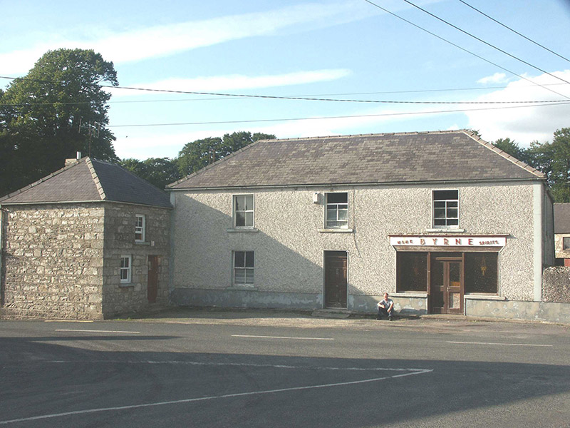 ByrneHouse · 4.4 mi
Explorer Tom Byrne in Rathdangan is stuck in a feud over who actually owns the view from that shopfront. It’s got some pebble-dash…
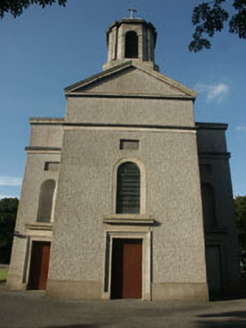 Saint Mary's Catholic ChurchChurch/chapel · 4.8 mi
Explorer Tom Saint Mary's Catholic Church in Killamoat Lower is dressed up in 1840s Classical style with Harry Clarke glass that…
 Sessile Oak6.0 mi
Explorer Tom Sessile Oak in County Wicklow holds the unofficial world record for looking the most bored while standing perfectly…
More mountains and hills in County Wicklow · All of County Wicklow

What do you know about this place?Tap to add a comment or ask a question