What is recorded here
From OpenStreetMap (© OpenStreetMap contributors) n11945549276
Places near here
Photo credits
- National Inventory of Architectural Heritage
- Kenneth Allen, Wikimedia Commons · CC BY-SA 2.0
- Gerard Lovett from ireland, Wikimedia Commons · CC BY 2.0
- National Library of Ireland on The Commons; photograph by Thomas H. Mason, Wikimedia Commons · No known copyright restrictions
- N Chadwick, Geograph · CC BY-SA 2.0
- N Chadwick, Wikimedia Commons · CC BY-SA 2.0
- Kenneth Allen, Geograph · CC BY-SA 2.0
- Anne Burgess, Geograph · CC BY-SA 2.0
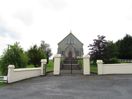 Church of the Immaculate ConceptionChurch/chapel · 1.1 mi
Explorer Tom Corrahoash’s Church of the Immaculate Conception is a 1925 Gothic Revival gem, featuring stone crucifixes and stepped buttresses on its nave.
 TobermurvyHoly well · 1.5 mi
Explorer Tom Tobermurvy in Derrynalester is a drystone gem where patterns were held every August, so check the landowner before you go.
 TobermurrySpring · 1.5 mi
Explorer Tom As a holy well, Tobermurry might just wish you luck if you bow politely, so let's go see if the water is actually magical.
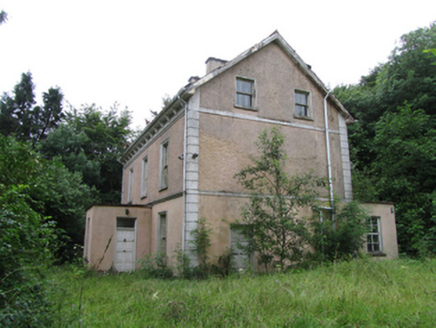 Corrard HouseHouse · 2.0 mi
Explorer Tom Corrard House stands as a stately T-plan residence from 1925, proudly displaying its slate roof and charming dormer attic in County Cavan.
 Shannon PotSpring · 3.0 mi
Explorer Tom Shannon Pot is a spring in County Cavan, where the water reflections shine so brightly that even a polarizer filter cannot hide them.
Síonnan and the Salmon: Shannon PotLegend location · 3.0 miExplorer Tom Síonnan and the Salmon: Shannon Pot has a curious woman chasing the Salmon of Wisdom and a pool that responds by overflowing into a river. That is a lot of water for one question. I would take a notebook, but I would keep it well above the edge.
 IndicatedFairy fort / stone ringfort · 3.6 mi
Explorer Tom This massive Moneygashel stone fort features internal stairways, an underground passage entrance, and a blocked water conduit from a stream.
 BurrenMountain / peak · 4.7 mi
Explorer Tom This Burren peak near Moneygashel feels like a sturdy guardian of the Cavan landscape, watching over the valley.
 Cavan Burren ParkForest · 4.8 mi
Explorer Tom Cavan Burren Park is a forest, and I bet the rocky landscape here feels like a mini adventure in itself.
 Lough MacNean WalkWalking route · 4.8 mi
 Boulder GraveyardArchaeological place · 4.9 mi
Explorer Tom Boulder Graveyard features large erratics partly supported by masonry, with burial chambers hollowed out underneath in the Cavan Burren.
 Rosscorkey IslandIsland · 5.5 mi
More mountains and hills in County Cavan · All of County Cavan

What do you know about this place?Tap to add a comment or ask a question