Places near here
Photo credits
- Jon Sullivan, Wikimedia Commons · Public domain
- Mcg sean, Wikimedia Commons · CC BY-SA 3.0
- National Inventory of Architectural Heritage
- Kenneth Allen, Geograph · CC BY-SA 2.0
- Jo and Steve Turner, Geograph · CC BY-SA 2.0
- Oliver Dixon, Geograph · CC BY-SA 2.0
- Kenneth Allen, Geograph · Creative Commons Attribution-ShareAlike 2.0
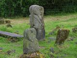 Boa IslandIsland · 1186 yd
Explorer Tom Boa Island gives you a bridge at each end, as if Fermanagh knew I would forget where I came in. It is Lower Lough Erne's largest island, about eight kilometres long. Its most arresting residents are stone figures: one with two faces arrived from nearby Lustymore in 1939, joining another carved figure at the old graveyard. Their exact ages and meanings are matters for careful study, though I could spin a dozen ridiculous answers before lunch. I would rather let you see both faces and decide what questions to ask. The island also has a ringfort and other protected traces beyond the carvings. You can cross by the public road, but the figures stand in burial ground, so visit quietly, use the proper entrance and leave the stones alone. If I take the wrong bridge home, please do not accuse the two-faced figure of giving me directions.
possible church site: kill park in ArdshankillPossible church site: kill park · 1398 ydExplorer Tom Possible church site: kill park in Ardshankill is a place that might have had a church but now it’s just a possibility hanging in the air like unfinished laundry. It’s got that 'maybe this, maybe that' energy which is very annoying if you’re looking for solid facts to hang on. I bet it has a rivalry with more famous sites because it can’t commit to a name. Go before the tourists find out.
 Castle McGrathCastle, tower house · 1398 yd
Explorer Tom Castle McGrath was called a 'prittie castle' in a 1611 account, but I would give its five-storey tower-house and gun-looped bawn a sterner name. Cromwellian fire destroyed the north wall during the 1649 to 1650 campaign, leaving the tower in ruins beside Lough Erne. 'Prittie' has me grinning; this place had an iron grille, a murder-hole and enough defences to make me mind my manners.
Penal site: altar park in DrumgrenaghanPenal Site: Altar Park · 1.3 miExplorer Tom Penal site: altar park in Drumgrenaghan is constantly picking fights with the wind because it thinks the breeze is trying to blow its history away. It stands firm, mostly out of stubbornness and a bit of bad attitude. Pretend it's yours and plan the housewarming.
Drumharriff WoodForest recreation place · 1.4 miExplorer Tom Drumharriff Wood is basically a ghost train station that refuses to admit it’s closed, which is why the bishop who refused to visit probably had a point about the vibes. The path follows old railway lines, so expect to feel like you’re walking through time, but slower and wetter. Have a nosey, politely.
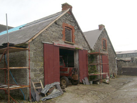 outbuilding1.4 mi
Explorer Tom Outbuilding in Aghafoy looks like two very serious boxes that forgot to hug. Built around 1880, I reckon those red brick arches are just a fancy way of saying, 'Please do not let the cows in.' It might have once served a local landlord’s estate lands or forestry plantations.
 goods shed1.5 mi
Explorer Tom Goods shed in Drumharriff has an infilled round-headed arch that used to let engines roll right inside. Built c. 1866, I wonder if the steam coaches felt like they were sneaking into a very smoky garage.
 Pettigo InnRestaurant · 1.5 mi
Explorer Tom Pettigo Inn is full of people talking about Pettigo as if it were Paris right now. Nod along and order the special; you won’t know what it is until it hits your tongue with a punch. Best seen with a hangover and a sausage roll.
 Britton’s BarPub · 1.5 mi
Explorer Tom Britton’s Bar in Pettigo dates from eighteen sixty and smells like old wood and last calls. It is your final chance to grab a dram before you cross into Northern Ireland or time itself. A good place to forget your phone for ten minutes.
 Cruninish IslandIsland · 1.6 mi
Explorer Tom Cruninish Island in County Fermanagh was nearly sold for a horse once because the owner couldn't decide between keeping it or buying a better steed. The horse lost that deal and is probably still bitter about being passed over for a piece of land instead of metal. Practise your Irish on it, it won't correct you.
 Sallow IslandIslet · 1.6 mi
Explorer Tom Sallow Island has very strong opinions about modern buildings, particularly anything with glass windows which it finds pretentious and reflective in the worst possible way. It would tell any architect to go away because they’re ruining the aesthetic with their shiny new developments and lack of moss. Bring a jacket, it's never as warm as I promise.
 Stone Figures in Caldragh Graveyard: Boa Island in DreenanStone Figures in Caldragh Graveyard: Boa Island · 1.9 mi
Explorer Tom Stone Figures in Caldragh Graveyard: Boa Island in Dreenan once had a fox take full charge of the graveyard for a week. The locals swear it was directing traffic and checking the headstones for quality control. Best seen with a hangover and a sausage roll.
More islands in County Fermanagh · All of County Fermanagh

What do you know about this place?Tap to add a comment or ask a question