
What is recorded here
Map note: Tayock Burn is recorded near Newbigging, Angus, Scotland as a man-made underground passage. The past can keep its secrets; the map gives you a starting point.
Places near here
Photo credits
- Anne Burgess, Wikimedia Commons · CC BY-SA 2.0
- Dominic Dawn Harry and Jacob Paterson, Wikimedia Commons · CC BY-SA 2.0
- Shaun Ferguson, Wikimedia Commons · CC BY-SA 2.0
- Alan Morrison, Wikimedia Commons · CC BY-SA 2.0
- Scott Cormie, Wikimedia Commons · CC BY-SA 2.0
- JThomas, Wikimedia Commons · CC BY-SA 2.0
- Leslie Barrie, Wikimedia Commons · CC BY-SA 2.0
- friedfish, Wikimedia Commons · Public domain
- Stanley Howe, Wikimedia Commons · CC BY-SA 2.0
- Adrian Diack, Wikimedia Commons · CC BY-SA 2.0
 Sleepyhillock CemeteryCropmark(s), Rig and Furrow (medieval) - (post Medieval), Ring Ditch (possible) · 450 yd
 NewbiggingPit(s), Unenclosed Settlement · 762 yd
 TayockPit(s), Rectilinear Enclosure, Ring Ditch (prehistoric) (possible), Man-made underground passage (iron Age) (possible) · 938 yd
 Pugeston, BridgeRoad Bridge · 1335 yd
 WellhillFarmstead · 1437 yd
 North Esk RoadNo Class (event) · 1659 yd
 Rosehill CemeteryCemetery · 1.1 mi
 Montrose, Dorward HouseNo Class (event) · 1.3 mi
 Mid LinksPark · 1.3 mi
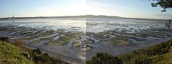 Montrose Basin Local Nature ReserveNature reserve · 1.3 mi
 Montrose AcademyVisitor information · 1.5 mi
 Montrose Basin Wildlife CentreVisitor information · 1.9 mi
More archaeology and monuments in Angus · All of Angus

What do you know about this place?Tap to add a comment or ask a question