What is recorded here
Situated on level ground in gently undulating terrain. A well-preserved moated site consisting of a large trapezoidal enclosure (int. dims. 50m E-W; 46m N-S) defined by an earth and stone bank (Wth 1.8-2.2m; max. int. H 1m) with an internal wall-facing (H 0.8m) and an external stone facing in a slight batter to the base of the fosse. The fosse (Wth c. 8m; D 2-2.5m) is steep-sided and flat-bottomed. There is an entrance in the E side (Wth 6m) with a causeway (Wth 5m) across the fosse. Three small towers survive; the best preserved is in the NW angle, which projects slightly (c. 1m) beyond the line of the bank. There is a tower at the midpoint of the W wall, another towards the E end of the N wall, and there may have been a fourth in the NE corner. The latter seems to have had internal access via a flight of stone steps. No visible internal features.
The above description is derived from the published 'Archaeological Inventory of County Wicklow' (Dublin: Stationery Office, 1997). In certain instances the entries have been revised and updated in the light of recent research.
Date of upload/revision: 17 December 2008
This monument is subject to a preservation order made under the National Monuments Acts 1930 to 2014 (PO no. 148/1940).
The monument record does not grant public access. Check the route and ask the landowner before entering private land.
- What survives
- Recorded monument
Places near here
 TobernachristhamaunHoly well · 584 yd
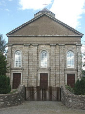 Saint Brigid's Catholic Churchchurch/chapel · 664 yd
 Font in UnknownFont · 1377 yd
 Humewood Castlegate lodge · 1.0 mi
 Sam McAllistair GraveMemorial · 1.0 mi
 MoatamoyCastle, motte · 1.1 mi
 Saint Brigit's Mass StoneNamed rock · 1.5 mi
 Saint Brigit's ChairNamed rock · 1.5 mi
 European BeechEuropean Beech · 2.0 mi
 Castle in ruinsCastle, unclassified · 2.1 mi
 Chapel (in ruins), GraveyardChurch · 2.4 mi
 Keadeen MountainMountain / peak · 2.5 mi