Places near here
Photo credits
- National Inventory of Architectural Heritage
- Kenneth Allen, Wikimedia Commons · CC BY-SA 2.0
- Gerard Lovett from ireland, Wikimedia Commons · CC BY 2.0
- National Library of Ireland on The Commons; photograph by Thomas H. Mason, Wikimedia Commons · No known copyright restrictions
- Kenneth Allen, Geograph · CC BY-SA 2.0
- Anne Burgess, Wikimedia Commons · CC BY-SA 2.0
- N Chadwick, Geograph · CC BY-SA 2.0
- Richard Webb, Wikimedia Commons · CC BY-SA 2.0
- Anne Burgess, Geograph · CC BY-SA 2.0
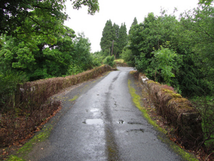 Old BridgeBridge · 2.2 mi
Explorer Tom An old poet fell in the ditch near this Old Bridge while trying to rhyme 'Cavan' with 'savannah.' The humped-backed form is typical of its time, but honestly, it looks like it’s about to do a handstand. Stay on the road.
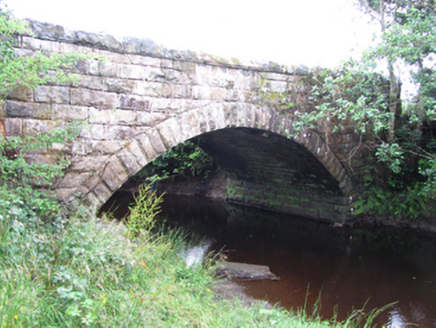 New BridgeBridge · 2.4 mi
Explorer Tom New Bridge in Kilduff Lower spans two counties and thinks it’s the boss of both. I bet Queen Victoria visited secretly to check if her bridge was still standing, but nobody admits it. Keep your eyes open for royal ghosts.
 TobermurvyHoly well · 2.5 mi
Explorer Tom Tobermurvy in Derrynalester holds patterns in August, which means the local sheep probably have opinions on whether the water is too cold or not. Tell the next person you meet it’s haunted; it might actually be true.
 TobermurrySpring · 2.6 mi
Explorer Tom Tobermurry in County Cavan lost a bet to a priest who swore he’d never drink from it again. Now he’s stuck watering his garden with holy water and regret. Pick a stone, any stone, and invent its biography.
 Shannon PotSpring · 6.1 mi
Explorer Tom The Shannon begins with a pool in Cavan that looks far too modest for Ireland's longest river. Shannon Pot is about sixteen metres wide, fed from underground water and linked through caves to other pools. Divers reached a depth of 14.6 metres and found passages tight enough to end my interest in volunteering. A poem from around 1349 already called it the source of the Shannon. Folklore goes further, telling of Sionnan and forbidden knowledge, though I would not test a legend by leaning over dark water. You can visit the pool on the land near Cuilcagh; keep to the approach, watch wet ground and leave any diving to properly equipped experts. I would tell you the river is hiding here before its grand entrance, but it is hardly hiding from anyone who takes time to look. Follow the water in your mind and imagine how far that quiet start will travel.
 IndicatedFairy fort / stone ringfort · 6.8 mi
Explorer Tom Fairy fort or stone ringfort in Moneygashel has seven steps built into the wall and blocked-up internal staircases, looking like it’s trying to hide its secrets from prying eyes. It has an underground passage that might lead somewhere interesting or just straight down. Tell the next person you meet it's haunted. It might be.
 Lough MacNean WalkWalking route · 7.0 mi
Explorer Tom Lough MacNean Walk in County Leitrim would order a double chipper with vinegar and absolutely no apologies. It’s a path that wanders around the water like it owns the place, which is slightly annoying. Spot the oldest stone and give it a name.
 Cavan BurrenVisitor attraction · 7.9 mi
Explorer Tom Cavan Burren is rocky, crumbly, and looks like someone dropped a giant bag of gravel and left. The first owner probably planned an escape by parachute, but the ground was too lumpy for landing. Sit on a wall near it and pretend you're in a painting.
 BurrenMountain / peak · 7.9 mi
Explorer Tom If Burren walked into a chipper, it would order the lot with extra vinegar and complain that the fries weren't crispy enough, which is exactly how I imagine this peak behaves at social gatherings. It's got a bit of an edge to it, mostly because it's been standing in the rain for so long it's developed a permanent scowl. Perfect place to be dramatically windswept.
 BenboMountain / peak · 8.1 mi
Explorer Tom Benbo was saved by a hero named Seamus who nobody remembers because he died of indigestion before the credits rolled on his bravery. He did the right thing but had the wrong stomach for the occasion, which is a classic Leitrim tragedy. Ideal place to rehearse an excuse for being late.
 Boulder GraveyardArchaeological place · 8.1 mi
Explorer Tom Boulder Graveyard is absolutely showing off its massive stones and thinks it deserves a proper housewarming party for the effort. Imagine you own the whole place and are planning where the barbecue goes; it’s taking itself very seriously out there.
 Rosscorkey IslandIsland · 8.2 mi
Explorer Tom Rosscorkey Island has a ghost that is far too lazy to haunt properly, preferring to nap in the tall grass instead of rattling chains for attention. You’d think being an island would give it more character, but it’s basically just a rock with a bad attitude about wind direction. Tell me if the gossip I made up is true.
More archaeology and monuments in County Leitrim · All of County Leitrim

What do you know about this place?Tap to add a comment or ask a question