What is recorded here
Situated on the N bank of a small W-E stream and c. 10m S of an abandoned farmhouse. A sweathouse is marked only on the 1907 edition of the OS 6-inch map. A small hollow (diam. c. 2m) is visible in the bank of the stream, in an area that is now forested (Bing 2013). Moore (Dublin: Stationery Office, 2003).
From the National Monuments Service (Archaeological Survey of Ireland) record LE018-077
The monument record does not grant public access. Check the route and ask the landowner before entering private land.
- What survives
- Recorded monument
Places near here
Photo credits
- Kenraiz, Wikimedia Commons · CC BY-SA 3.0
- Willow, Wikimedia Commons · CC BY 2.5
- Kenneth Allen, Geograph · CC BY-SA 2.0
- National Inventory of Architectural Heritage
- Oliver Dixon, Geograph · CC BY-SA 2.0
- Andreas F. Borchert, Wikimedia Commons · CC BY-SA 4.0
- Kenneth Allen, Wikimedia Commons · CC BY-SA 2.0
Drummans IslandIslet · 1221 ydfprtFairy fort / earthen ringfort · 1221 yd Black Poplar1.2 miEuropean ash1.2 miDrumkeeran Church (Inishmagrath)Church/chapel · 1.2 miSaint Brigid's Catholic ChurchChurch/chapel · 1.3 miCorry IslandIslet · 1.4 miScardan WaterfallWaterfall · 2.0 miForde's CastleCastle · 2.0 miLough AllenLarge freshwater lake · 4.5 miTobermurvyHoly well · 6.0 miTobermurrySpring · 6.0 mi
 Black Poplar1.2 mi
 European ash1.2 mi
 Drumkeeran Church (Inishmagrath)Church/chapel · 1.2 mi
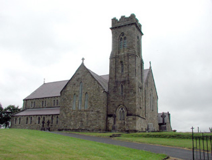 Saint Brigid's Catholic ChurchChurch/chapel · 1.3 miCorry IslandIslet · 1.4 mi
 Scardan WaterfallWaterfall · 2.0 miForde's CastleCastle · 2.0 mi
 Lough AllenLarge freshwater lake · 4.5 mi
 TobermurvyHoly well · 6.0 mi
 TobermurrySpring · 6.0 mi
More archaeology and monuments in County Leitrim · All of County Leitrim
What do you know about this place?